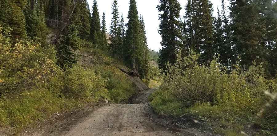
The narrow road to Schofield Pass in Colorado is for experienced drivers only
Schofield Pass is a high mountain pass at an elevation of 3,272m (10,734ft) above sea level, located in Gunnison County, in the U.S. state of Colorado. If you feel uncomfortable at any point, do not be tempted to follow; turn around and go back.
Can you drive through Schofield Pass in Colorado?
Located near Crested Butte, the road to the summit is totally unpaved. It’s called FSR #317 (also known as Upper South Fork Crystal River Road). It’s also known as Gothic Road. This route should only be attempted by very skilled and experienced four-wheel drivers, and only in jeep-type, small, high-clearance 4WD vehicles. The pass is named after B. F. Schofield, who was a silver miner in the area.
How long is the road to Schofield Pass in Colorado?
The road is 22.4 km (13.91 miles) long, running north-south from Crystal Mill to Mt Crested Butte. It is the high point on the road connecting the towns of Marble and Crested Butte. While the road has been tamed recently to be drivable, there are several demanding sections that are unforgiving.
When was the road to Schofield Pass in Colorado built?
The road through the pass is an old wagon route between Crested Butte and the Crystal/Marble area. The first road over the pass was built in 1873. Views and scenery are well worth the rough, long trip. Parking is available in the town of Crystal. Two miles from the trailhead lies Geneva Lake.
Is the road to Schofield Pass in Colorado open?
Set high in the Sawatch Range of central Colorado, road closures can be frequent, so check conditions before traveling to this area. The road is impassable from October to July. Be aware of early-season snows. Rock slides are common, so check conditions before departing. Weather and rock conditions may make this section impassable due to melting snow drifts or rockslides that narrow the road. At other times, the ride is relatively easy if you are not afraid of heights.
Is the road to Schofield Pass in Colorado dangerous?
It's said to be the most deadly pass in Colorado, and for good reason. There are deaths (17 at last count) or very serious accidents every year. Most accidents occur on the descent from Schofield Park to the Devil's Punchbowl. One danger is drivers not drying out their brakes after a deep creek crossing before the steep descent. The Devil's Punchbowl section is a rock ledge drive along a cliff of up to 300 feet. You may have to back up a long distance if you meet an oncoming vehicle. Rock slides are common and occasionally close the trail. 4x4 with experienced drivers and a narrow wheelbase only. The road to the summit is suitable for a passenger car if traveling from the east; however, after this, it is rated 4-wheel drive only as it switchbacks down the west side through the Devil's Punchbowl Canyon and becomes a narrow, rocky shelf road. A signal warns: This is the last chance to turn around or pass a vehicle for miles. NARROW road with steep drop-offs. If you are not on foot, bike, or ATV, turn around NOW! Do not be lulled into complacency by "casual" and beautiful sections that ultimately lead you into the upper reaches of the Crystal River gorge. The track is rutted and rocky with large holes. If you have anything but a 4 x 4, avoid the drive. It could lead to car damage, especially the undercarriage of your vehicle.
Pic: gautam gurnurkar