Chillycoat Pass: Driving the 91-mile Divide Road
Chillycoat Pass is a high mountain pass at an elevation of 2,935m (9,629ft) above sea level, located in Mesa County, Colorado. Situated within the Dominguez-Escalante National Conservation Area, the pass is a key point along the Divide Road. Logistically, this is one of the longest continuous high-altitude gravel traverses in the state, running along the spine of the Uncompahgre Plateau.
| Road facts: Chillycoat Pass | |
|---|---|
| Location | Mesa County, Colorado (USA) |
| Elevation | 2,935 m (9,629 ft) |
| Distance | 91.7 miles (147 km) |
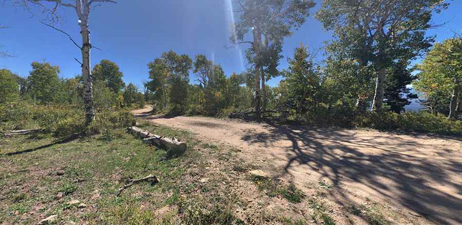
| Surface | Gravel and dirt (High-clearance 4WD required) |
How to navigate the 91-mile Divide Road to Chillycoat Pass?
The road through Chillycoat Pass spans 91.7 miles, running North-South from the paved CO-141 to Mesa Road. Technically, the Divide Road follows the crest of the plateau, meaning it is exposed to sustained high winds and rapid barometric shifts. Logistically, the sheer length of this unpaved track is the primary hazard. There are no refueling points or services for nearly 100 miles. Drivers must ensure a full tank and carry reserve fuel, as the high-altitude engine load and constant gear hunting on the gravel surface will significantly increase consumption beyond standard estimates.
What are the technical hazards of the Dominguez-Escalante route?
The terrain around Chillycoat Pass consists of a mix of graded gravel and sections of "bentonite" clay. Technically, even moderate rainfall turns the surface into "adobe mud," which is notorious for sticking to tires and wheel wells, effectively neutralizing tread patterns and making steering impossible. Logistically, a high-clearance 4WD vehicle is mandatory, not just for the inclines but to navigate the deep ruts and washouts that form after the spring thaw. The 9,629ft elevation also means snow can block the higher sectors of the Divide Road well into June, requiring self-recovery gear like winches or Maxtrax.
What are the mechanical requirements for the Chillycoat Pass traverse?
Driving 91 miles on the spine of the Uncompahgre Plateau puts specific stress on a vehicle’s suspension and cooling systems. Technically, the constant vibration from the washboard gravel can loosen bolts and fatigue shock absorbers. Logistically, safety protocols for the Chillycoat Pass route mandate carrying at least two full-sized spare tires; the volcanic rocks along the plateau are sharp and can easily cause sidewall delamination. Due to the remoteness of the Dominguez-Escalante area, communication is technically limited; satellite messengers are a necessity, as mobile signals are blocked by the plateau’s topography for most of the 91.7-mile journey.
Pic: Blind Endeavors