Oreana Ridge: Driving the 4x4 track to the 1934 fire lookout in Idaho
Located in the rugged heart of Lemhi County, Idaho, Oreana Ridge is a high mountain peak reaching an elevation of 2,470m (8,103ft) above sea level. Situated within the massive Salmon-Challis National Forest, the drive to the summit is a classic Idaho backcountry experience, combining a technical 4x4 climb with a trip back in time to the era of mountain fire surveillance.
| Road facts: Oreana Ridge | |
|---|---|
| Location | Lemhi County, Idaho, USA |
| Elevation | 2,470 m (8,103 ft) |
| Road Number | FR-067 (Forest Road 067) |
| Length | 4.5 km (2.8 miles) |
| Surface | Gravel / Dirt 4x4 Track |
Where is the road to Oreana Ridge?
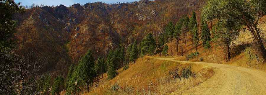
The road to the summit is designated as Forest Road 067 (FR-067). It branches off from Spring Creek Road, deep within the northern Idaho wilderness. The geography is dominated by steep, timbered ridges and deep canyons that characterize the Salmon-Challis region. This is a remote area where you are far more likely to encounter local wildlife than other travelers, and the isolation requires that you carry full self-recovery gear before leaving the main forest routes.
Is the road to Oreana Ridge unpaved?
Yes, the FR-067 is a gravel 4x4 track that is not maintained for standard passenger cars. The surface is a mix of loose mountain gravel and dirt that can become extremely slick after a rain shower. The track is narrow and snakes along the ridge with significant exposure. A high-clearance 4WD vehicle is essential, as the road often features deep ruts and rocky sections that will catch low-hanging underbodies. If the weather turns severe, the track can transform into a muddy slide, making it impossible to maintain traction on the steeper ramps.
How long is the road to Oreana Ridge?
Starting from the junction with Spring Creek Road, the climb to the summit is 4.5 km (2.8 miles) long. While the distance is short, it is a constant upward pull that gains significant elevation in a very few miles. The road leads directly to a historic fire lookout built in 1934, which still stands at the peak. Driving this stretch requires a slow pace to pick the right lines over the rocks. The final few hundred yards toward the lookout are often the most technical, where the wind-scoured soil leaves the larger stones exposed.
What are the hazards at the Oreana Ridge lookout?
The biggest hazard at Oreana Ridge isn't just the road surface, but the extreme exposure to lightning. Because the peak is a high point in the forest, it acts as a natural lightning rod. If there is a thunderstorm in the area, you should stay away from the lookout and the ridge entirely. High winds are also a constant factor at 2,470 meters, which can make steering a high-profile vehicle tricky on the narrowest parts of the FR-067. Always check the Lemhi County weather forecast before committing to the climb, as the ridge is no place to be when the Idaho mountain weather breaks.
Pic: Bob McDonald