How to get by car to Pinyon Peak lookout in Idaho?
Pinyon Peak is a high mountain peak at an elevation of 3,032m (9,947ft) above sea level, located in Custer County, in the U.S. state of Idaho. It's one of the highest roads in Idaho.
Where is Pinyon Peak?
The peak is located within the Salmon-Challis National Forest, in the center of Idaho.
Can you drive to Pinyon Peak in Idaho?
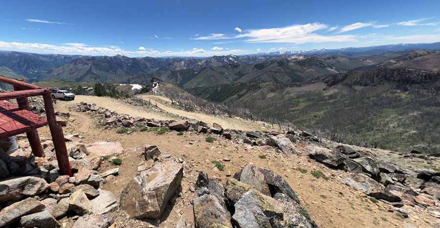
The road to the summit is completely unpaved. It’s called Pinyon Peak Loop Road (NF-172). It’s a long, grueling, and intense drive. A 4x4 vehicle is required. This area is remote, so please take necessary precautions and use common sense.
How long is the road to Pinyon Peak in Idaho?
The road to the summit is 42km (26.1 miles) long, running from NF-008 (Seafoam Road) to Loon Creek Road. The last 1.7km (1.05 miles) to the summit are extremely challenging, featuring 8 sharp hairpin turns. The switchbacks up to the peak are steep, and low range is desired for the long, steep descent.
Is Pinyon Peak in Idaho worth it?
Set high in the heart of the Eastern Salmon River Mountains, the summit hosts a fire lookout called Pinyon Peak Fire Lookout Station. Built in 1930, it has been in active service since then. The summit offers unobstructed mountain panoramas in all directions. Great views include several well-known mountains such as Mt. Baldy, Twin Peaks, the White Clouds, the Sawtooths, and on the distant horizon, Borah Peak, Idaho's highest.
Pic: 1337hero _