How To Travel The South Eureka Valley Road in Death Valley National Park
South Eureka Valley Road is a very exciting desert drive, located in Inyo County in the U.S. state of California. It’s one of the challenging backcountry roads in Death Valley National Park.
Where is the South Eureka Valley Road?
The road, running through a landscape off an alien planet, is located in the eastern-central part of California, near the Nevada border, within Death Valley National Park.
Is the South Eureka Valley Road unpaved?
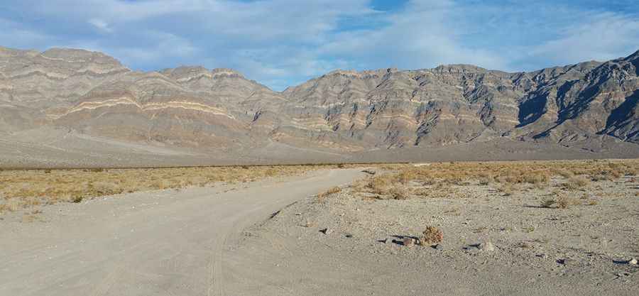
The road is totally unpaved. Due to frequent flooding in the area, road conditions often vary throughout the park. High clearance 2-wheel drive is required. In order to complete the drive, better deflate the tires to run it comfortably and not beat up on the suspension when driving at 30 mph. RVs and trailers are not recommended due to the rough roads. For the most up-to-date information on road conditions, visit Death Valley’s website at nps.gov/deva.
How long is the South Eureka Valley Road?
It’s 15.77 km (9.8 miles) long, running from Loretta Mine Road (Death Valley Road) to Eureka Dunes Dry Camp. Eureka Dunes are the highest sand dunes in California at nearly 700 feet and home to several endemic plant species. Driving on the dunes or off established roads is prohibited. Beyond the dunes, the road becomes rough 4WD and is called the Steel Pass Road.
What are the weather conditions like?
Temperatures can range from highs of 120°F in summer to lows around 40°F in winter. The wind can be brutal, making conditions even more challenging. For your safety, avoid extreme weather and check forecasts before setting out.
When is the best time to go?
To avoid the weekend crowd and harsh conditions, plan your trip during the cooler months and midweek if possible. Summer heat and windy conditions can make the trip uncomfortable and dangerous.
Pic: Richard Lanouette