How to Travel the Owl Hole Spring Road in Death Valley NP
Owl Hole Spring Road is an exciting desert drive located in San Bernardino County, in the US state of California. It is one of the most remote locations in the park and one of the challenging backcountry roads in Death Valley National Park.
Where is the Owl Hole Spring Road?
The road is in the southern portion of California, within Death Valley National Park.
Is the Owl Hole Spring Road Unpaved?
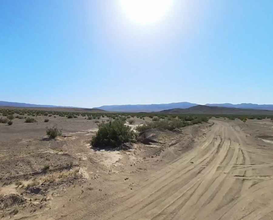
The road, also known as Owl Springs Road, is completely unpaved, with sandy sections. Due to frequent flooding, road conditions often vary throughout the park. For the most up-to-date information on road conditions, visit Death Valley’s official website at nps.gov/deva. The road is passable for stock SUVs and trucks, but 4WD is recommended. Be sure to avoid the military bases surrounding the park, as unexploded ordnance and active bombing practices make them extremely dangerous to enter.
Is the Owl Hole Spring Road Worth the Drive?
The route offers excellent views of the surrounding landscape and provides the only access into the most remote and rugged part of the park: the Owlshead Mountains.
How Long is the Owl Hole Spring Road?
The road is steep, climbing almost 4,000 feet. It is 47.79 km (29.7 miles) long, running from Harry Wade Road to an abandoned military radio tower/repeater at an elevation of 1,218m (3,996ft) above sea level. The climb near the end of the route is steep and may be washed out in some areas.
Pic: James Hatton