The Wild Road to Deadman Pass in Death Valley NP
Deadman Pass is a mountain pass at an elevation of 996 m (3,267 ft) above sea level, located in Inyo County, in the U.S. state of California. It’s one of the challenging Backcountry roads in Death Valley National Park.
Where is Deadman Pass?
The road is located in the east-central part of California, within Death Valley National Park.
Is the Road Through Deadman Pass Unpaved?
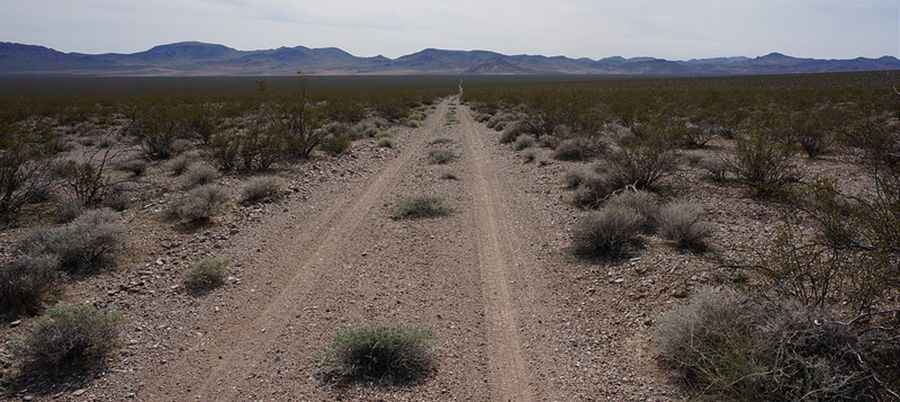
Set high in the Greenwater Range, the road to the summit is completely unpaved. It is called Deadman Pass Road and is generally considered an easy backroad drive.
How Long is Deadman Pass?
The road is 25.26 km (15.7 miles) long, running north-south from Highway 127 to Furnace Creek Wash Road.
How Challenging is Driving Through Deadman Pass?
The last 1.5 miles to Highway 127 consist of deep, loose gravel. High-clearance 2WD is sufficient up to the pass from Furnace Creek Wash Road, but high-clearance 4WD is required to reach Highway 127. Travel is slow, as the road crosses many drainages. Due to frequent flooding, road conditions vary throughout the park. This trail passes through remote areas, so preparation is essential. For the most up-to-date information on road conditions, visit Death Valley’s website at nps.gov/deva.
Pic: http://www.death-valley.net/forum/viewtopic.php?t=22187