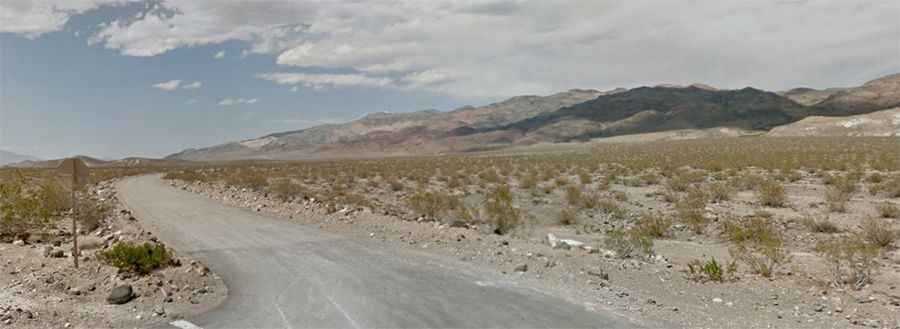
Driving the truly epic Big Pine Death Valley Road
Big Pine Death Valley Road is a very exciting desert drive in the heart of Death Valley National Park, in the USA. It’s often signed as CLOSED by Inyo County after floods.
Where is Big Pine Death Valley Road?
The road is located in Inyo County, in the eastern central part of California.
How long is Big Pine Death Valley Road?
Big Pine Death Valley Road is 112 km (69.7 miles) long, running from Ubehebe Crater Road to Highway 168, near Zurich (in Inyo County). The drive comprises Eureka Valley Road, Loretta Mine Road, and Waucoba Road.
Is Big Pine Death Valley Road open?
The road tops out at 2,334 m (7,657 ft) above sea level. It can be snowy in winter or washed out at any time. Carry chains in winter.
Is Big Pine Death Valley Road paved?
The road is mostly unpaved. The final section from Eureka Valley west to Highway 168, near Zurich (in Inyo County), is paved. As the main backcountry thoroughfare from the Scotty’s Castle area to Owens Valley, this maintained gravel road heads up the northern end of Death Valley and across Eureka Valley. Access roads to the Eureka Dunes and the North Pass into Saline Valley diverge from this road. High clearance vehicles are required when washed out by floods. Expect dust, heavy washboard, and occasional rough spots. For the most up-to-date information on road conditions, visit Death Valley’s website at nps.gov/deva.
Is Big Pine Death Valley Road challenging?
It’s one of the challenging Backcountry roads in Death Valley National Park. This trail passes through remote areas, so you need to be prepared. Death Valley National Park is said to be the hottest, driest, and lowest National Park. The road could be in decent shape or rougher, depending on recent weather conditions. There are no services along this route, and there can be large washouts in Eureka Valley. No camping along this road.