Steel Pass is a truly outstanding 4wd adventure in Death Valley
Steel Pass is a high mountain pass at an elevation of 1.565m (5,134ft) above sea level located in Inyo County, in the U.S. state of California. Experienced 4WD drivers only.
Can you drive to Steel Pass in Death Valley NP?
Tucked away in the eastern-central part of California, the road to the summit, also known as Steele Pass, is totally unpaved and becomes a bit rockier near the pass. It is called Steel Pass Road.
How long is the road to Steel Pass in Death Valley NP?
Set high in a very remote and rugged region of the Death Valley National Park, the road is 73.70km (45.8 miles) long, running north-south from Eureka Valley Road to Saline Valley Road. Travel is easier from north to south.
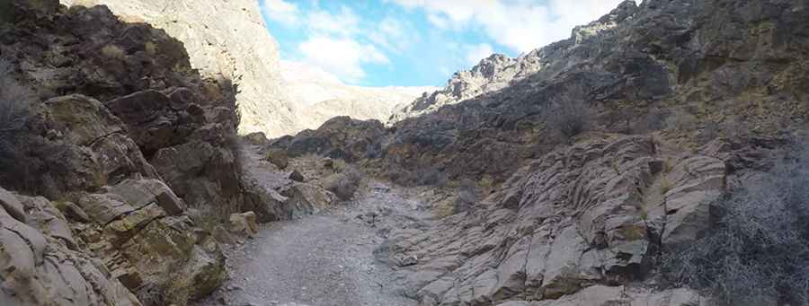
Is the road to Steel Pass in Death Valley NP challenging?
It’s one of the challenging Backcountry roads in the Death Valley National Park. The road is pretty defiant, with narrow parts, silt beds, canyons and ever changing washes. The road is very rugged and requires 4WD high clearance, and some planning, all the way. Best travelled with more than one vehicle. Longer-wheelbase vehicles may find the road challenging. Vehicles must be able to climb narrow, sharp dry falls. Sidewall cuts to tires are common so carry multiple spares. May be impassible after heavy rains. Waterfalls in Dedeckera Canyon require more advanced skills, and the wash coming into Saline Valley has some narrow turns with rocks on both sides. Be aware of gasoline requirements. Like much of Death Valley, this trail has no cell coverage
How long does it take to drive Steel Pass in Death Valley NP?
To drive the road without stopping will take most people between 2.5 and 3 hours. Due to frequent flooding in the area, road conditions often vary throughout the park. For the most up-to-date information on road conditions, visit Death Valley’s website at nps.gov/deva.
Pic: HighSierraOverland