How to Travel the Phinney Canyon Road in Nevada
Phinney Canyon Road is an exciting desert drive located in Nye County, in the U.S. state of Nevada. A high-clearance vehicle is required for the first 21 miles, and 4x4 is necessary beyond that. It’s one of the challenging backcountry roads in Death Valley National Park.
Where is the Phinney Canyon Road?
The road is located in the southern part of Nevada, near the California border, within Death Valley National Park.
How Long is the Phinney Canyon Road?
The road is completely unpaved and stretches 37 km (23 miles). The route starts 11.7 miles north of Beatty on Highway 95, forking towards Strozzi Ranch on the left and Phinney Canyon on the right.
Can I Drive My Vehicle on the Phinney Canyon Road?
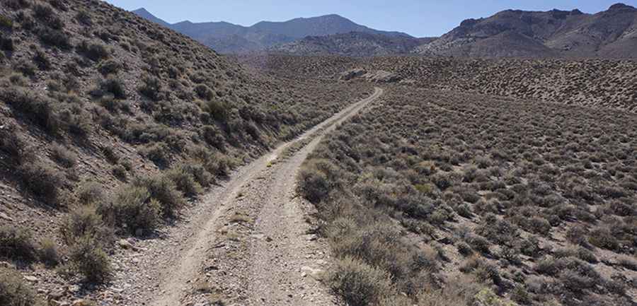
Tucked away in the Grapevine Mountains, the road is passable for most of the way with a high-clearance vehicle. However, the final stretch requires four-wheel drive, low-range capability, and a skilled driver. At one point, a gigantic boulder—the size of an engine compartment—blocks part of the road, requiring careful navigation. Due to frequent flooding, road conditions can change throughout the park. For the most up-to-date information, visit Death Valley’s website at nps.gov/deva.
Is the Phinney Canyon Road Scenic?
This is a remarkable road trip. After entering Phinney Canyon, the road winds through pinyon pine woodlands, offering travelers stunning views of the Grapevine Mountains high country and glimpses of the Sierra Nevada Range.
Pic&more info: http://www.greenshit.org/greenshit/GS13Story/gs13day2.html