How to drive the steep unpaved road to the lookout at Fairview Peak in Oregon?
Fairview Peak is a high mountain peak at an elevation of 1.812m (5,944ft) above sea level located in Lane County, in the U.S. state of Oregon.
Where is Fairview Peak?
The peak is located in a pretty remote area, in the southwestern part of Oregon, within the Umpqua National Forest.
Why is there a road to Fairview Peak?
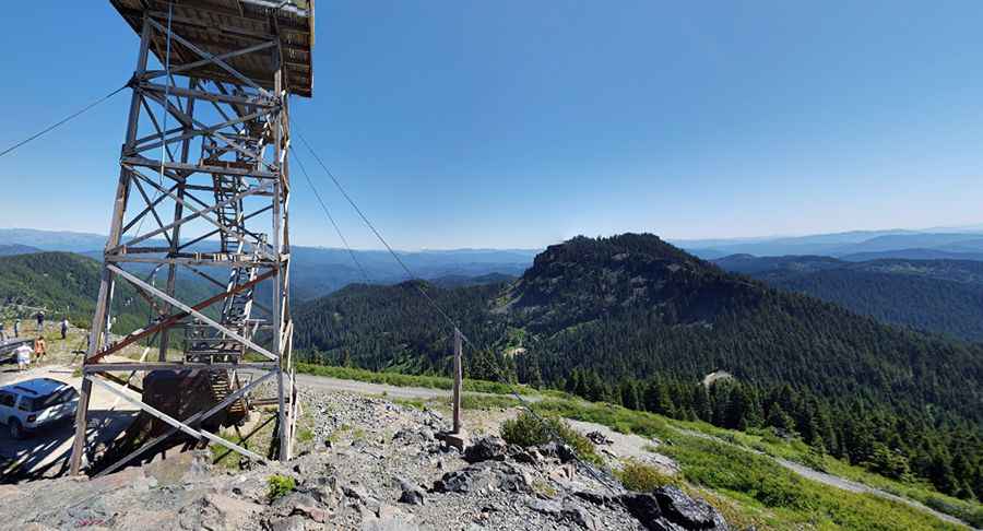
At the summit there’s a lookout tower. On a clear day, at Fairview Peak Lookout you can see north to Mount Hood, south to Crater Lake and Mt. McLaughlin and east to many prominent peaks in the Cascade Range.
Is the road to Fairview Peak unpaved?
The road to the summit is totally unpaved. It is a single lane, graveled road, located on a steep hillside. The road is narrow and rocky and high-clearance vehicles are strongly recommended. Proceed slowly and deliberately, using low gear.
How long is the road to Fairview Peak?
Starting from County Road 2460, the road to the summit is 1.93km (1.2 miles) long. Over this distance, the elevation gain is 167m (548 ft) and the average gradient is 8.65%.
Is the road to Fairview Peak open year-round?
At this elevation the road can be closed anytime due to snowfalls. The road is usually impassable from November to May. Between June and October, there may be inclement weather conditions such as snow and ice that can make accessing the lookout more dangerous.
Pic: Spencer Trim