How to drive the unpaved NF-20 Road to Grouse Creek Gap in Oregon
Grouse Creek Gap is a high mountain pass at an elevation of 2.020m (6,640ft) above sea level, located in Jackson County, in the U.S. state of Oregon.
Is the road to Grouse Creek Gap unpaved?
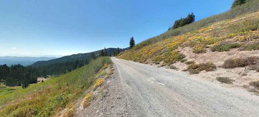
Located in the southern part of Oregon, the road to the summit is called NF-20. It’s a narrow, unpaved single-lane mountain ledge with a loose gravel and dirt surface. The track runs along a steep drop-off with no guardrails or side protections, carved directly into the mountain slope.
How long is the road to Grouse Creek Gap?
Starting from Mt. Ashland Ski Area, the road to the summit is 2.3 miles long.
Is the road to Grouse Creek Gap open year-round?
Set high in the Siskiyou Mountains, due to its high elevation the entire mountain pass is buried under heavy snow drifts from late October until late spring. During the winter months, motorized vehicular access is completely blocked, and the unpaved track is used exclusively for Nordic ski trails and snowmobiles.
Pic: Matthew Noyes