Driving the scenic Emerald Bay Road in Lake Tahoe
Emerald Bay Road is a very scenic drive located in the US state of California. Running along the Lake Tahoe, the road can be a bit intimidating and scary since it can occasionally be along steep cliffs that lack guardrails.
Where is Emerald Bay Road?
The road is located on the western shore of Lake Tahoe, on the eastern part of California, near the Arizona border.
Is Emerald Bay Road paved?
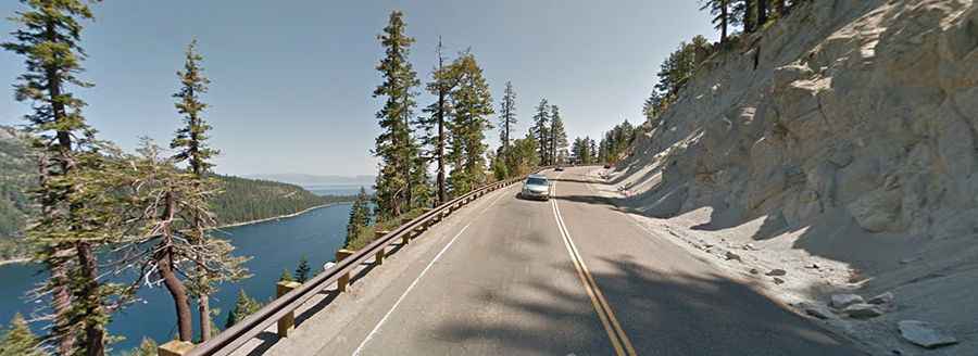
The road is totally paved. It’s part of Highway 89. The wicked road that is literally perched onto a very steep mountain ridge is not recommended for people afraid of heights. The drive is a little scary. It's a two-lane road, with no guardrails and big drop-offs on either side. But, it's really worth it. The road is perched high above two beautiful mountain lakes on the drive.
How long is Emerald Bay Road?
Tucked away in the Carson range of the Sierra Nevada, the road is 29.93km (18.6 miles) long, running south-north from Lake Valley (in El Dorado County) to Tahoma (in Placer and El Dorado counties). It tops out at 2.084m (6,837ft) above the sea level by Inspiration Point, 600 feet above Lake Tahoe. The lookout provides the perfect overlook for all of Emerald Bay, the boats, Vikingsholm, and Fanette Island. Parking can be difficult during busy summer months, especially between 10:00 a.m. and 4:00 p.m.
Is Emerald Bay Road challenging?
The road features some steep sections (up to 9%). There's one section where the road is atop a ridge separating Emerald Bay from Cascade Lake, about a 600-foot drop on both sides, and no guardrails. The section is a quarter-mile long only. It’s a mind-numbing vertical drop of hundreds of meters, so you might want to give it a miss on a windy day. It's beautiful, but precipitous.