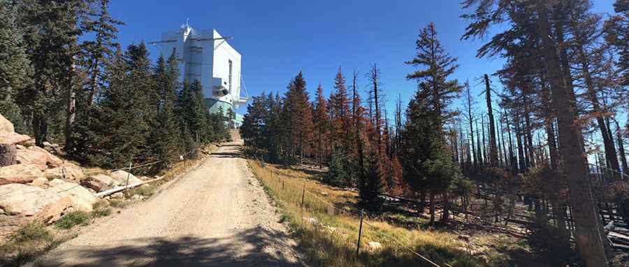
A steep unpaved road to Mount Graham in Arizona
Mount Graham is a high mountain peak at an elevation of 3.192m (10,472ft) above sea level, located in Graham County, in the U.S. state of Arizona. It's one of the highest roads of Arizona.
Where is Mount Graham in Arizona?
The peak is located to the northeast of Tucson, in the southeastern part of Arizona, within the Coronado National Forest.
Why is it called Mount Graham?
The peak was named in 1846 after the Army officer James Duncan Graham.
When was the road to Mount Graham in Arizona built?
The first road to the summit was started in the 1920s and was completed as far as Arcadia by about 1927.
Can you drive to the top of Mt. Graham?
The road to the summit is totally unpaved. SUV required. It’s called Mt. Graham International Observatory Road (4567). The summit is home to an observatory called Mount Graham International Observatory, built in 1993.
Is Mt. Graham closed?
Set high in the Pinaleno Mountains, the road is gated between November 15 and April 15. Since the late 1980s, the summit has been officially closed to the public.
Is the road to Mount Graham in Arizona steep?
The road to the summit is pretty steep. Starting at AZ-366 Road, the road is 3.21km (2 miles) long via 7 sharp hairpin turns. Over this distance, the elevation gain is 270 meters. The average gradient is 8.41%.
Pic: Iskren Georgiev