A road with 23 hairpin turns to Saxon Mountain in Colorado
Saxon Mountain is a high mountain peak at an elevation of 3.494m (11,463ft) above sea level, located in Clear Creek County, in the US state of Colorado. The road to the summit is very steep, with an average gradient of 8.17 %. The trail is currently closed because of safety concerns.
How long is the Saxon Mountain Road?
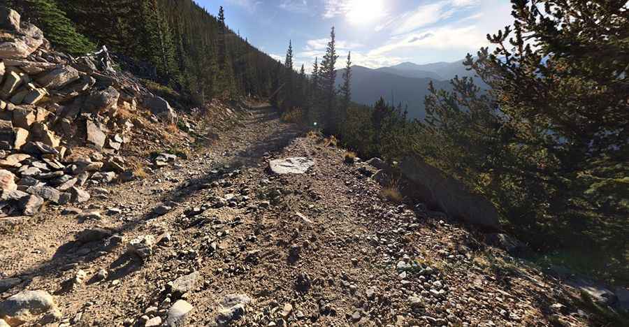
The Saxon Mountain Road is a steep shelf road with 23 switchbacks, stretching 7 miles (11 km) from the upper end of the Clear Creek valley to the summit. Located north of Georgetown, the road gains 899 meters in elevation, with an average gradient of 8.17% and a maximum slope of 14%.
When was the road to Saxon Mountain built?
The road was constructed in the 1960s or early 1970s for an aerial tramway project connecting Georgetown to Saxon Mountain's peak. The tramway was never completed.
How challenging is the Saxon Mountain Road?
The road is wide most of the way but very narrow in a few places. Be very careful after periods of heavy rain as boulders sometimes loosen and tumble onto the road. The drive features steep switchbacks and cliffs with no margins for error. A capable 4x4 vehicle is required. The road is usually impassable from November to May. It climbs through over 20 switchbacks to take you high over the town of Georgetown. Endless switchbacks are impressive. It's a narrow road in spots is prone to rock slides, especially after periods of heavy rain. The road is rocky and bone jarring. Rock falls are common, with the possibility that a large boulder could block the road at any time.
Is the Saxon Mountain Road worth it?
The drive offers great views of Georgetown, the I-70 corridor, and Mt. Evans. At the peak, a panoramic view of Mt. Evans and the Divide is visible. The area is rich in mining history, with old log cabins.
2021, 24th July Update: Extreme caution is needed as well as a capable 4x4. The trail is currently closed because of safety concerns.
Road suggested by: Hugh Wilson
Pic: JD WENBERG