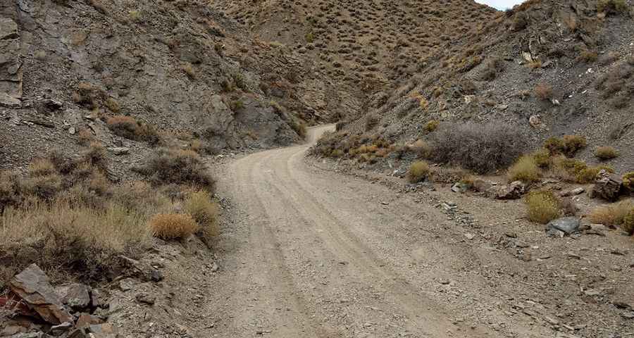
A remote unpaved road to Aguereberry Point in Death Valley NP
Aguereberry Point is a natural overlook at an elevation of 1,960m (6,433ft) above sea level, located in Inyo County, in the US state of California. It’s one of the challenging Backcountry roads in Death Valley National Park.
Where is Aguereberry Point?
The overlook is located on the west side of Death Valley National Park, in the eastern part of California, near Nevada.
Why is it called Aguereberry Point?
The viewpoint is named after Jean Pierre "Pete" Aguereberry, a Basque miner born in 1874 who emigrated from France in 1890. He worked and resided at the nearby Eureka Mine from 1905 until he passed away in 1945.
How long is the road to Aguereberry Point in Death Valley?
Starting on the paved Emigrant Canyon Road, the road to the summit is 10.29km (6.4 miles) long. Over this distance, the elevation gain is 401m (1,316 ft), and the average gradient is 3.89%.
Is the road to Aguereberry Point in Death Valley unpaved?
The road to the summit is entirely unpaved. It’s called Aguereberry Point Road. The drive is pretty challenging, requiring a high-clearance vehicle due to rock outcrop in the road at 3.5 miles and a steep, rocky final 0.5 mile to the viewpoint. Sedans may risk undercarriage damage, and the road is subject to snow and mud conditions. The road has a gentle slope and offers one of the most beautiful views in the park. It is pretty rugged and remote. Drive carefully and obey posted speed limits. Many wild animals, including the threatened desert tortoise, have been killed by speeding cars.
Is the drive to Aguereberry Point in Death Valley worth it?
Perched on the crest of the Panamint Springs Area, the drive is definitely worth it, and the view is spectacular on a clear day. Because of its westerly setting, this place is one of the best locations to photograph the valley in the afternoon and around sunset. It’s a beautiful area full of many interesting things to see. From this point on the Panamint Range, one can view the surrounding Panamints extending to the north and south, Mount Charleston to the east, Furnace Creek, and the salt flats of Badwater Basin. The road right by the summit, and on the way passes the remains of Harrisburg, a small and long-abandoned mining settlement.
How to drive in Death Valley National Park?
When traveling through this area, exercise caution, especially during severe weather. Summers bring high temperatures, intense sunlight, low humidity, and sudden storms that can cause flash floods and road closures. Plan your visit carefully, stay hydrated, and avoid hiking in extreme heat. Be prepared for emergencies by staying on paved roads and carrying extra water. Drive cautiously to avoid single-car accidents and watch for wildlife hazards. Hikers and four-wheelers should be self-reliant and inform someone of their plans. Avoid relying solely on cell phones due to potential service gaps. Safety tips include avoiding mine tunnels, canyons during rainstorms, and being aware of wildlife encounters. Dial 911 in emergencies, but note that cell service may be unreliable.
Pic: Jim Heald