How to drive the paved road to Barker Dam in California?
Barker Dam is a high mountain dam at an elevation of 1.301m (4268ft) above sea level, located in Riverside County, in the US state of California.
Where is Barker Dam?
The dam, also known as the Big Horn Dam, is located between Queen Valley and the Wonderland of Rocks near the Wall Street Mill, in the southern part of California. Located within the Joshua Tree National Park, it’s a beautiful area full of many interesting things to see. Many wild animals, including the threatened desert tortoise, have been killed by speeding cars. A few venomous animals live in the park, including rattlesnakes, scorpions, and black widow spiders. When hiking or climbing in the park, always look before you place your hands or feet. Avoid stepping or reaching into places you cannot see.
When was Barker Dam built?
It’s a water-storage reservoir constructed by ranchers in the early 1900's. In February of 2013 the dam was closed to public access due to numerous instances of graffiti and carvings on the dam itself, but is since reopened.
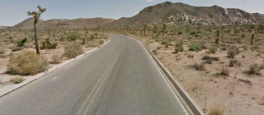
Is the road to Barker Dam paved?
The road to the dam is totally paved. It’s called Barker Dam Road. The road is pretty rugged and remote and is open for two-lane travel along its entire length. It ends on a parking lot.
How long is the road to Barker Dam?
Starting from Park Boulevard, the road to the dam is 1.5 miles long.
Is it dangerous to drive the road to Barker Dam in summers?
During the summer, expect high temperatures, intense sunlight, and low humidity. Storms and flash floods can be powerful and sudden. The road can be closed anytime due to flash flood damages caused by torrential rainstorms. Avoid canyons and washes during rainstorms and be prepared to move to higher ground. While driving, be alert for water running across dips in the road. Remember: turn around, don't drown.