Potosi Mountain is one of the gnarliest roads of Nevada
Potosi Mountain is a high mountain peak at an elevation of 2,580m (8,464ft) above sea level, located in Clark County, in the US state of Nevada.
Where is Potosi Mountain?
The peak is located on the southern end of the Spring Mountains, southwest of Las Vegas, in the southern part of Nevada.
Is the road to Potosi Mountain unpaved?
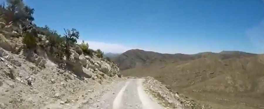
The unpaved road to the summit is very challenging, with narrow parts and drop-offs. It is called Forest Road 509 (Potosi Mountain Road). Check your brakes before attempting this route. The road is not difficult to the base of the South Summit, and a 2WD vehicle could probably make it at least. Conditions change for the last miles, and a 4x4 vehicle is required to complete the drive. The peak serves as a major FM broadcast transmitter site for Las Vegas. To that end, the road was constructed from the south to allow service vehicles to rumble to the top.
How long is the Potosi Mountain Road in NV?
Starting at Pauline Mine Road, the road to the summit, also known as Mount Potosi, Double Up Mountain, and Olcott Peak, is 9.65km (6.0 miles) long. Over this distance, the elevation gain is 1138 meters. The average gradient is 11.79%, hitting about a 25-30% road gradient through some of the ramps. A number of mines exist on the slopes of the mountain. One such mine is the famous Potosi Mine. There are a number of small shelter caves on the mountain.
How did Carole Lombard die?
The drive provides many excellent photo opportunities. Don't forget your camera. The summit dominates the Las Vegas skyline, and the views are tremendous. The mountain was the site of the DC-3 airplane air crash that killed 22 passengers, most notably the Hollywood actress Carole Lombard, in 1942. The site of the crash site is not meant to be revealed, although dedicated searchers have found it.
Pic: Roy Myers