The road to Thompson Pass, the snowiest place in Alaska
Thompson Pass is a mountain pass at an elevation of 841m (2,759ft) above sea level, located in Valdez–Cordova Census Area, in the US state of Alaska.
Where is Thompson Pass?
The pass is located in the heart of the Chugach Mountain Range, northeast of Valdez.
Why is Thompson Pass famous?
The pass played a significant role during the Klondike Gold Rush as a route used by prospectors heading to Alaska's interior. During World War II, it was part of the route used to deliver supplies to Valdez, an important port during the construction of the Alaska Highway.
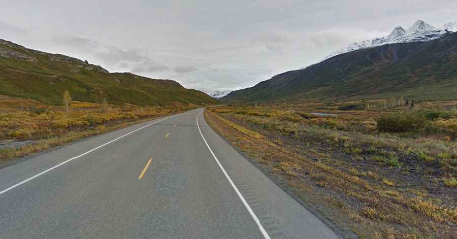
Is the road to Thompson Pass paved?
The road to the summit is called Richardson Highway. It’s a good, 2-lane paved highway. It was fully paved in 1955. The drive offers stunning views of glaciers, waterfalls, and towering peaks.
How long is the road to Thompson Pass?
The pass road is 132km (82.5 miles) long, running north-southwest from Tonsina to Valdez. Thompson Pass is the highest point on the highway, connecting the interior of Alaska to the coastal town of Valdez.
Is the road to Thompson Pass open?
Due to its elevation and proximity to the Gulf of Alaska, it frequently experiences severe weather, including snowstorms and avalanches, especially in winter. Access to the pass is typically open all year round, with the occasional closure in winter due to dangerous weather conditions. The pass can be nerve-racking to drive through in the right conditions at any time of year. The zone around the pass is the snowiest place in Alaska, recording 551.5 inches (1,401 cm) of snow per year on average. The winter of 1952–1953 saw 974.5 inches of snowfall on the summit — the most ever recorded in one season at one location in Alaska. It is also prone to avalanches due to its steep terrain and heavy snow accumulation.