Driving to Kerr Notch: The best view of Crater Lake’s Phantom Ship
Kerr Notch is a high mountain pass at an elevation of 2,038m (6,686ft) above sea level, located on the southeastern rim of Crater Lake in Oregon. It is one of the most significant geological and historical points on the Rim Drive, offering a unique perspective on the massive volcanic collapse that created the deepest lake in the USA.
Geologically, Kerr Notch is a "U-shaped" valley that was carved by massive glaciers before the cataclysmic eruption of Mount Mazama about 7,700 years ago. When the mountain collapsed, it cut these glacial valleys in half, leaving the "notches" we see today. Kerr Notch is also famous for being the spot where the first recorded party of settlers caught their first glimpse of the lake in 1853, naming it "Deep Blue Lake" at the time.
| Road facts: Kerr Notch | |
|---|---|
| Location | Crater Lake National Park, Oregon |
| Elevation | 2,038 m (6,686 ft) |
| Road Name | East Rim Drive |
| Nearby Landmark | Phantom Ship Island |
| Surface | Paved / Asphalt |
How is the drive to Kerr Notch?
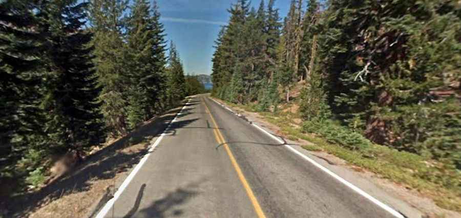
The road to the pass is part of the East Rim Drive. While it is fully paved and in excellent condition, it is a demanding mountain road. The route is narrow, winding, and completely lacks shoulders or guardrails in many sections. This can be intimidating for drivers suffering from vertigo, as the drop-offs on both sides of the ridge are steep and unprotected.
From a driving perspective, Kerr Notch is a major milestone on the loop. It marks the access point for the spur road leading to the Pinnacles Overlook, another must-see volcanic site. If you are driving a large RV or towing a trailer, be aware that the descent into the notch from the higher points of the rim involves steep gradients. Use your engine to brake and avoid overheating your pads on the long downhill stretches.
What can you see from Kerr Notch?
The primary draw of Kerr Notch is the spectacular view of the Phantom Ship. This jagged island of 400,000-year-old andesite rock looks like a ghost ship under sail, especially in the early morning mist. Because Kerr Notch is the lowest point on the rim's southeastern edge, it provides a closer and more intimate angle of the water than the higher viewpoints like Sun Notch (2,176m), located just a few miles to the west.
The parking area at Kerr Notch can get very crowded during peak summer hours. Since the road is narrow and shared with many bicyclists, it’s important to stay within the designated turnouts. It’s a key stop on the Volcanic Legacy Scenic Byway, and the different light throughout the day makes it a favorite for photographers capturing the intense blue of the lake.
When is Kerr Notch open?
Kerr Notch is located on the East Rim, which is the last section of the park to be cleared of snow. While the southern entrance may open in May, the road through Kerr Notch often remains closed until late June or early July. Snow drifts in this shaded part of the caldera can reach heights of 60 feet (18 meters). The best time to visit is from mid-July through September. By October, the first winter storms often bring ice to the higher hairpins, making the East Rim Drive treacherous once again.