Driving the Hazardous California State Route 17
Located in the U.S. state of California, Highway 17 stands out as one of the most dangerous roads in the country. Along the way, it presents drivers with a multitude of hazards – sharp turns, blind spots, narrow shoulders, changes in speed, and slick highway surfaces after rains or snow.
How long is California State Route 17?
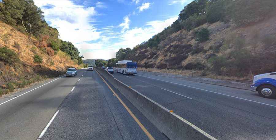
State Route 17 is a scenic road that winds its way through the Santa Cruz mountains, connecting San Jose (the largest city in Northern California) and Santa Cruz (on the northern edge of Monterey Bay). State Route 17 (SR 17), commonly known as Highway 17, stretches from Scotts Valley in the south to Los Gatos and San Jose in the north, covering a paved distance of 26.49 miles (42.63 km).
How challenging is it to drive on Highway 17?
The road, constructed in the 1930s, boasts narrow lanes and perilously tight curves, earning it ominous nicknames such as "Killer 17" and "Blood Alley." It has been designated as one of California's most dangerous roads. The heightened risk is attributed to the abundance of sharp and blind curves, as well as sudden changes in speed along the route. Consequently, drivers often face difficulties negotiating unexpected sharp turns, sometimes careening off the median divider. Numerous accidents on this route can be attributed to sharp turns, blind curves, heavy traffic, and occasional wildlife encounters. According to various sources, the number of serious and deadly crashes on Highway 17 has more than quadrupled in the last decade. For instance, in 2016, there were 983 crashes, compared to 420 in 2013. This increase has led locals and news outlets to label it as one of California’s most perilous highways.
Common Dangers of Highway 17

What To Do if You’re Injured in a Car Accident on Highway 17
Highway 17’s treacherous curves, steep inclines, and unpredictable weather volatility are well-documented for causing frequent accidents involving cars, motorcycles, and sometimes pedestrians. Because of its well-documented unsafe driving conditions which endanger lives daily, the highway's numerous risks to travelers include collisions, property damage, substantial injuries and even fatalities.
If you're involved in a car accident on Highway 17, prioritize your safety and call Emergency Services immediately. Get medical attention right away, even if your injuries seem minor. Be sure to document the accident scene with photos and collect witness information. Then, report the accident to law enforcement, which is crucial for when you file a personal injury claim. To make the filing process easier, Highway 17 accident victims should hire a personal injury lawyer who is experienced and knowledgeable in California laws.
A skilled personal injury lawyer will:
- Identify all recoverable Highway 17 accident damages
- Protect you from insurance company lowball tactics
- Negotiate for the highest compensation on your behalf
- Offer you support, not only now but also long-term
Hiring expert legal representation, like that offered by the California-based law firm Braff Law Car Accident Slip and Fall Personal Injury Lawyers, will ensure your rights are safeguarded and maximize your financial recovery during this challenging time. Whether you are the victim of a Highway 17 car accident, motorcycle accident or pedestrian accident, a skilled personal injury attorney brings extensive knowledge of California law and a compassionate approach to every case. By thoroughly investigating the circumstances surrounding your accident on Highway 17, they build compelling cases to hold negligent parties accountable.
Furthermore, a knowledgeable personal injury lawyer’s commitment to personalized service means they will stand by your side throughout the entire legal process. A personal injury attorney provides guidance, support, and aggressive advocacy to help you achieve the best possible outcome. With personalized legal strategies tailored to your own unique Highway 17 accident situation, a personal injury lawyer will fight aggressively for full compensation covering your medical bills, lost wages, pain and suffering, property damage and future care needs. A successful personal injury attorney’s proven track record in Highway 17 accident cases provides peace of mind that you have a dedicated advocate by your side throughout the legal process.
Is California State Route 17 dangerous in winters?
During the winter months, SR 17, crossing a high precipitation area in the Santa Cruz Mountains, becomes slippery from rain, snow, or ice. This heightened risk is particularly noticeable at Patchen Pass, the highest point of the road, situated at an elevation of 562m (1,843ft) above sea level. Depending on the time of year, road conditions are further compromised by rain, fog, and snow, leading to instances where a car hitting the median and spinning out of control often involves other cars, resulting in multi-car serious accidents.
Is Highway 17 in the Santa Cruz Mountains haunted?
Highway 17 has garnered a reputation as one of the most haunted roads in California. Across generations, numerous drivers and passengers have reported witnessing apparitions walking or standing along the highway, with some claiming to see them sitting in the back seats of cars. Others have alleged sightings of white vaporous clouds floating over the lanes. Some even assert encountering the ghost of a 17- or 18-year-old girl walking along the road at twilight. In addition to sightings of wandering spirits, visitors navigating through sharp turns have reported hearing sounds of collisions and tires screeching to a halt. Interestingly, upon inspection, no reckless drivers are found at the scene. Commuters have even reported seeing ghosts of Native Americans along scenic roads during the dark hours. On Highway 17 and Lee Road in Watsonville, the spirit of an old Indian man has been sighted traveling on foot, with legend suggesting that he is responsible for causing all the accidents on the road.
Road suggested by: Chen