North Ogden Divide is an awe-inspiring road in Utah
North Ogden Divide is a high mountain pass at an elevation of 1,887m (6,190ft) above sea level, located in Weber County, in the US state of Utah.
Where is North Ogden Divide?
The pass is located in the northern part of Utah, within the Uinta-Wasatch-Cache National Forest.
How long is the North Ogden Divide?
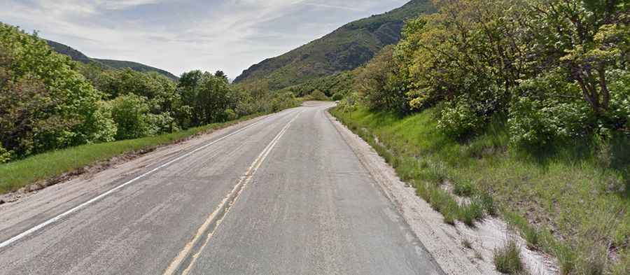
The road to the summit is totally paved. It’s called North Ogden Canyon Road, known to locals as “The Divide.” The road is 9.65km (6 miles) long, running west-east from North Ogden to Liberty.
Is North Ogden Canyon Road worth it?
The drive offers spectacular alpine scenes. The summit hosts a parking lot and the Indian Trails Monument. The road is exceedingly beautiful no matter what season you choose to go through it in.
Is the North Ogden Divide dangerous?
It is a dangerous road, but there is very little alternative. This 6-mile serpentine strip of pavement has minimal shoulders and a 600-foot drop. The road is very steep and has steep grades, hitting an 11.2% maximum gradient through some of the ramps. There is a high risk of avalanches and falling boulders.