Driving the Scenic Coastal Drive Loop of California
Coastal Drive Loop is a very scenic road located at the far northwest corner of the U.S. state of California, running along the Pacific Ocean. Whales, sea lions, and pelicans may often be seen from overlooks high above the crashing surf. is one of the most scenic drives in the Redwood National and State Parks.
Where is Coastal Drive Loop?
The road lies in Del Norte County, within Redwoods National Park. Once a two-way route, it is now a one-way loop, offering some of the most dramatic coastal scenery in Northern California.
How long is Coastal Drive Loop?
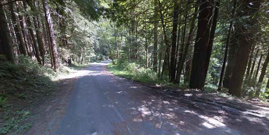
The drive is about 9 miles (14.5 km) long, mostly unpaved in sections. This narrow, winding road features steep grades and sharp curves, rewarding drivers with panoramic views of the ocean and the Klamath River estuary.
Road Conditions and Restrictions
The former southern portion of Coastal Drive, from Alder Camp toward Carruthers Cove, is closed to motor vehicles.
The northern section, starting north of Alder Camp, remains open to the public. This stretch is mostly paved, with a one-way, northbound section between High Bluff Overlook and Klamath Beach Road.
⚠️ Important Note: The northern section beyond High Bluff Overlook is not suitable for RVs or vehicles towing trailers.
This road is very exciting and sometimes very exposed and unsecured driveway in innumerable twists and turns. This narrow road with steep curves and sharp grades offers wide panoramic views of the Pacific Ocean and Klamath River estuary. Enjoy a picnic with breathtaking views at the High Bluff Overlook, and don't miss the World War II radar station-disguised in the 1940s to look like a humble farmhouse and barn. Hiking and backcountry camping can be accessed from the Flint Ridge section of the Coastal Trail.
How to Get There
From Highway 101, take the exit to West Klamath Beach Road. Turn left on Alder Camp Road, which later veers north and merges with Coastal Drive, now a one-way route. The road eventually rejoins West Klamath Beach Road, completing the loop.
What to Expect on the Drive
The route is narrow and winding, with steep curves and sharp grades, offering breathtaking panoramic views of the Pacific Ocean and Klamath River estuary.
The road is mostly paved and navigable by passenger vehicles, but motorhomes, RVs, and trailers are prohibited due to its tight turns and exposed edges.
Points of Interest
- High Bluff Overlook: A perfect spot for a picnic with spectacular ocean views.
- World War II Radar Station: A hidden site disguised in the 1940s to look like a farmhouse and barn.
- Flint Ridge Section of the Coastal Trail: Offers access to hiking and backcountry camping