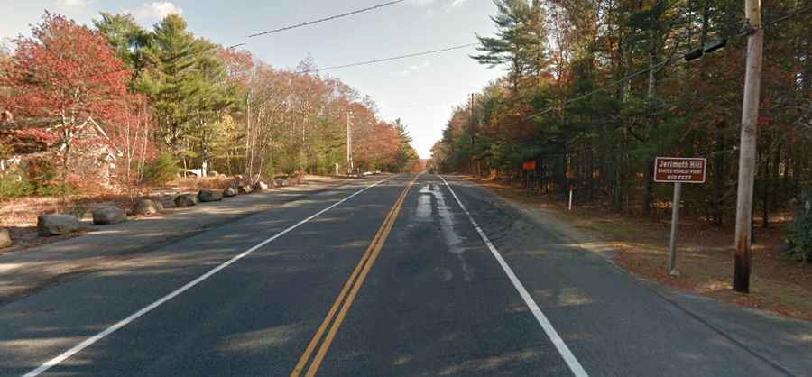
A road to Jerimoth Hill, the highest point in Rhode Island
At 247m (812ft) above sea level, Jerimoth Hill is the highest natural point in the US state of Rhode Island.
Where is Jerimoth Hill?
Jerimoth Hill is located in the town of Foster, in Providence County, in the northwestern part of Rhode Island near the Connecticut border.
How long is the road to Jerimoth Hill?
The road to Jerimoth Hill is totally paved. It’s called Rhode Island Highway 101, also known as Old Hartford Pike. It’s totally straight. It’s 15.44km (9.6 miles) long, running east-west from US-6 Highway to the border of Connecticut. At this elevation it's the highest paved road in Rhode Island.
How to reach Jerimoth Hill, the roof of Rhode Island?
On the highway, there’s a sign indicating that Jerimoth Hill is on the shoulder of the highway, but that is not the actual high point. To reach the roof of Rhode Island, you hike south 500 feet, past an abandoned and dilapidated house, and gain about ten feet of elevation to the summit. It is in the woods to the south. You can park on either the north or south side of the highway.