Sawyers Bar Road: 12 miles of snake track using 1st gear in California
Sawyers Bar Road is a stunning drive in the Klamath National Forest, in the US state of California. The drive features a 3,713ft drop in 12 miles of snake track, using 1st gear. Brakes are just not suitable for that long of an incline. One of the best rides in California, without a doubt.
How long is Sawyers Bar Road?
Tucked away in Siskiyou County, the road is fully paved now but a few years ago it had some gravel sections. It’s 64.05km (39.8 miles) long, running from Forks of Salmon, situated at the confluence of the north and south forks of the Salmon River, to Etna, in the Scott Valley area. Sawyers Bar is perhaps the most picturesque of the northern mining towns. It was founded in 1850 by Captain John Best.
How long does it take to drive Sawyers Bar Road?
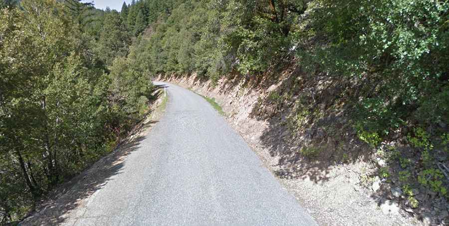
Plan about 1.30 hours to complete the drive without any stop. The most challenging part of the road runs between Etna Summit (5960') and Sawyers Bar (2247'). You’ll do a pretty big climb on a pretty straight road, but past the summit the road gets smaller, prettier, and windier and stays that way. The drop down the back side touches 18%. The road is very rough and mostly one lane. The speed is very slow most of the way, like 10-15mph. The road is really remote and almost no services are available. It can get bloody hot on summer afternoons. Sound horn on all blind curves. Not recommended for campers, trailers, or drivers inexperienced in mountain driving. No services for 40 miles. The road is usually deserted. The road surface is very good. The scenery is stunning and the riding is constantly changing.
Is Sawyers Bar Road dangerous?
Set high in the northernmost part of California, the road climbs up to Etna Summit and tops out at 1.827m (5,994ft) above sea level. This is really a spectacular little road. The road follows the North Fork of the Salmon River as it narrows and gets even twistier. There is a serious drop off to the left: about 500 feet straight down. It is mostly one to one and a half lanes wide, and after the summit of Etna mountains follows the river valley about half way up the hill. On one side is the mountain and on the other a drop off, many times quite steep and sheer, to the river below. There are many places where the ground under the road is eroding away and there is a little plastic marker indicating the drop off. Through the years, occasional rock slides have occurred, and the cliff face is collapsing onto the road.
Road suggested by: William Hunt