Bolam Pass in Colorado: The Ultimate Road Trip Guide
Bolam Pass is a high mountain pass at an elevation of 3,487m (11,440ft) above sea level, located in the U.S. state of Colorado. Although the lower portions of the road to the summit can accommodate cars, the upper portions should only be traveled by 4WD vehicles with high clearance.
Where is Bolam Pass in Colorado?
The pass is located on the boundary between Dolores and San Juan counties, in the southwestern part of Colorado, within the San Juan National Forest.
Can you drive through Bolam Pass in Colorado?
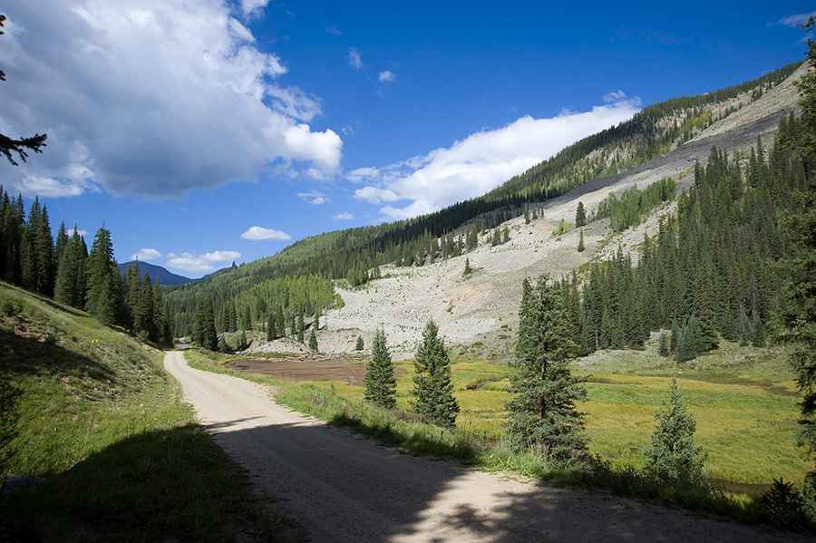
The road to the summit is totally unpaved. It’s called Forest Service Road 578 (Hermosa Park Road), also known as Bolam Pass Road.
Is the road to Bolam Pass in Colorado challenging?
The trail is very smooth and easy for the first 11 miles. Suddenly, the trail becomes bumpy, and progress is slow for the rest of the way. It's like two different trails. There are spots that are rough, along with some shallow water crossings. The eastern half of this Jeep trail is well graded, while the western half is somewhat rutted and bumpy. Beware of treacherous stream crossings on the east side. The trail requires 4WD low, high clearance, sturdy tires, and plenty of time.
Is Bolam Pass in Colorado open?
The road is not plowed in winters. It’s usually impassable from late October through late June or early July (depending on snow). The area is quite remote, and good conditions are only likely in summer. Be prepared for changing weather on this high elevation ride.
Where does Bolam Pass start and end?
The pass runs from US 550 -south of Silverton- to State Highway 145 -to the north of Rico-.
Is Bolam Pass in Colorado worth it?
The drive is very rewarding with scenic views. The trail follows numerous remnants of Colorado's mining heritage. It’s said to be one of the best and most remote single tracks in Colorado. It serves as a shortcut from Durango (near Hermosa) to Telluride.
Pic: Tom C