Hurrah Pass in Moab: The Ultimate Road Trip Guide
Hurrah Pass is a mountain pass at an elevation of 1.461m (4,793ft) above sea level, located in the US state of Utah. At times the road to the pass is very thin and very close to the edge of far drops.
Where is Hurrah Pass in Moab?
The pass is located on the boundary between San Juan and Grand counties, in the southeastern portion of Utah.
How long is Hurrah Pass in Moab?
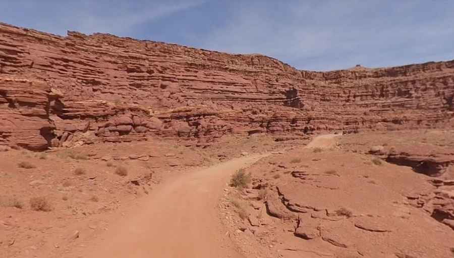
The road to the summit is totally unpaved. It’s called Chicken Corners Trail. It’s 23.81 km (14.8 miles) long running from Kane Creek Canyon Road to Fielder Natural Arch. Kane Creek Road is usually dry, but can be impassable for brief periods during flash flooding. The road follows the Colorado River downstream, climbs up to the pass (the highest point of the road) and descends to benches above the Colorado River.
Do I need a 4x4 to drive through Hurrah Pass in Moab?
The road is suitable for stock, high-clearance, 4x4 SUVs, but you might not use your 4WD. This trail is easy and extremely scenic until the last 4-5 miles, and then it gets pretty rough and is 4x4 territory. There are a few turns that may take your breath away looking straight down into the canyons but very worth it.
Can I drive to Hurrah Pass in Moab now?
The road through the pass is usually accessible all year-round and the view from the top of the pass is very nice, overlooking the Colorado river and Potash Evaporation ponds.
Is Hurrah Pass in Moab worth the drive?
The views along the way are fantastic. The summit of Hurrah Pass will leave you in awe as you look out to the bottom of Dead Horse Point and all the way over to Canyonlands National Park.
When is the best time to drive through Hurrah Pass in Moab?
Best driven in late spring and fall. Hot in summer. This is a wonderful drive best done early in the morning for good pictures and to avoid the traffic later in the day.
Pic: More To Living