Driving the wild road to Mount Ord in Arizona
Mount Ord is a high mountain peak at an elevation of 2,173m (7,128ft) above sea level, located in Maricopa County, in the US state of Arizona. A high-clearance vehicle is recommended.
Where is Mount Ord in Arizona?
Mt. Ord is located on the northeastern edge of Maricopa County of central Arizona within the Tonto National Forest.
Why is it called Mount Ord?
The peak is named after Major General Edward Ord, who commanded an army during the final days of the Civil War.
Can You Drive to Mt. Ord?
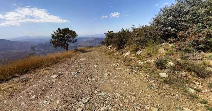
The dirt road to the summit is entirely unpaved. It’s called Forest Road 27 (FR27). It’s unpaved with a few tippy washouts and ruts. The first part of the climb is accessible by any passenger car. But the second part is just for 4x4’s. It’s a very narrow high shelf road intimidating to beginners, or those not fond of heights. There are also some extremely tight brushy areas. The road is generally well maintained. There are several hairpin turns with sharp drop-offs and no guardrails where it’s not fun to meet another truck.
How Long is the Road to Mount Ord in Arizona?
Starting from the Duthie-Martin Highway, the road to the summit is 12.23km (7.6 miles) long. Over this distance, the elevation gain is 1188 meters. The average gradient is 9.71%.
Is Mount Ord in Arizona Worth It?
The entire ride is full of tremendous panoramic views, and from the top, you will enjoy amazing panoramic views of the surrounding Tonto National Forest, Mogollon Rim, Lake Roosevelt, Four-Peaks Mountains, and Saguaro Lake. Mount Ord has several communication towers as well as a forest service tower, built by the Forest Service in 1983. Pay special attention to spiders and snakes. There are some dangerous species around.
Is Mount Ord in Arizona open in winter?
Set high in the Mazatzal Range, in the winter, it gets cold enough to snow.
Pic: Tom Keplinger