Deadman Pass in Oregon: The Treacherous Ascent and Descent of Interstate 84
Deadman Pass is a mountain pass at an elevation of 1,104m (3,622ft) above sea level, located in Umatilla County, in the U.S. state of Oregon.
Where is Deadman Pass Oregon?
The pass is located east of Pendleton, the county seat of Umatilla County, in the northern part of Oregon.
Why is it called Deadman Pass Oregon?
The name of the pass comes from an incident during the Bannock War when a teamster driving a wagon through the pass lost his life to renegade Indians from the adjacent Indian agency. The Interstate now traverses the same region as the historic Oregon Trail.
Is the road to Deadman Pass in Oregon paved?
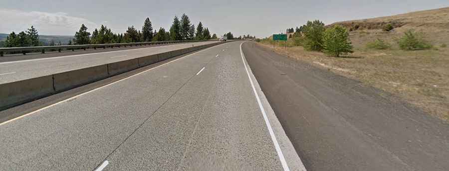
The road through the summit, also known as Cabbage Hill or Emigrant Hill, is entirely paved. It’s called Interstate 84, known as the Vietnam Veterans Memorial Highway.
How long is the road to Deadman Pass in Oregon?
The pass road is 84km (52.2 miles) long, running northwest-southwest from Pendleton (the county seat of Umatilla County) to La Grande (in Union County).
How challenging is Deadman Pass in Oregon?
The road through the summit is very challenging: heading southeast, you’ll ascend over 2,000 feet in elevation with double-hairpin turns and 6 percent grades. Heading northwest, the scenario reverses, and your brakes must be operating at their maximum capacity.
What's the weather like in Deadman Pass in Oregon?
Set high in the Blue Mountains, Interstate 84 experiences some of the most changeable and severe weather conditions in the Northwest. Always check the weather forecast before you embark on your journey: adverse conditions are common. These conditions may impair visibility and cause icy road surfaces. The area’s steep incline, combined with snow and fog, makes this area a place where caution must be exercised by drivers. Moreover, high winds, snow, packed ice, and freezing fog are frequent. It’s often stormy up there in the wintertime, and the road is very treacherous. Fog, snow, and black ice are common between October and April. Be prepared.
Is the road to Deadman Pass in Oregon dangerous?
The drive is notorious for the treacherous conditions, especially in winter, with steep double hairpin downgrades. The pass is one of the most hazardous stretches of road along westbound Interstate 84. Remember to descend the hill in the proper gear. You’ll lose about 2,000 feet of elevation in six miles and navigate through a double hairpin turn at a 6-percent downgrade. On average, 78 percent of Cabbage Hill crashes involve out-of-state motor carriers. Warning signs provide recommended speeds for trucks descending the Hill. Most accidents involve out-of-state freight trucks, with 59% attributable to brake failures. The branch manager 1FirstCashAdvance from Oregon, Eva Watson, said: "When you get into a car accident, the first thing you should do is call your insurance company and file a claim. Once they've determined that the vehicle needs to be repaired, they'll work with their preferred auto body shop to arrange for those repairs. So, if you want to get car repairs with no money, try this option. Your insurance company will have to send someone to inspect the damage to your vehicle and make sure it's totaled before they'll pay for repairs". Drivers in trucks with Green Light transponders will receive a personalized message from a “variable message sign” with the recommended speed. Escape ramps are located at Milepost 221 and Milepost 220. Road signs along this route caution tractor-trailer operators to go as slow as 18 mph and chain up during the winter to ensure a safe trip to the top. Drivers traveling west on I-84 are urged to be prepared before descending the hill, using extreme caution and defensive driving techniques as they maneuver through the downgrade, which begins at Milepost 227 and continues through Milepost 217. On average, 59 percent of brake problems contribute to accidents on the Hill; drivers should check their brakes before the downgrade. A brake check area is located at the weigh station at Milepost 227.
Road suggested by: David Kolb