Driving the scenic Cherohala Skyway through the mountains
Straddling Tennessee and North Carolina, the Cherohala Skyway is one of the most scenic drives in the USA.
When was the Cherohala Skyway built?
The road was completed in the fall of 1996 after 34 years of construction, costing over 100 million dollars. It has been designated a National Scenic Byway.
Why is it called Cherohala Skyway?
The road derives its name from the two National Forests it traverses: "Chero" from the Cherokee and "Hala" from the Nantahala.
How long is the Cherohala Skyway?
The road is fully paved. It’s 83.36km (51.8 miles) long and runs west-east from Tellico Plains (in Monroe County, Tennessee) to Robbinsville (in Graham County, North Carolina). It’s also known as the Overhill Skyway. The drive comprises Tennessee State Route 165 (western side) and North Carolina Highway 143 (eastern side).
Is there snow on the Cherohala Skyway?
The road tops out at 5,400ft (1,600m) above sea level, on the slopes of Haw Knob near the Tennessee-North Carolina state line, at Santeetlah Overlook. You can be caught in pea soup fog, thick clouds, and bone-chilling temperatures even in July. It can be cold and cloudy riding the mountain ridges, so make sure you dress properly, even in the summer months.
Is the Cherohala Skyway dangerous?
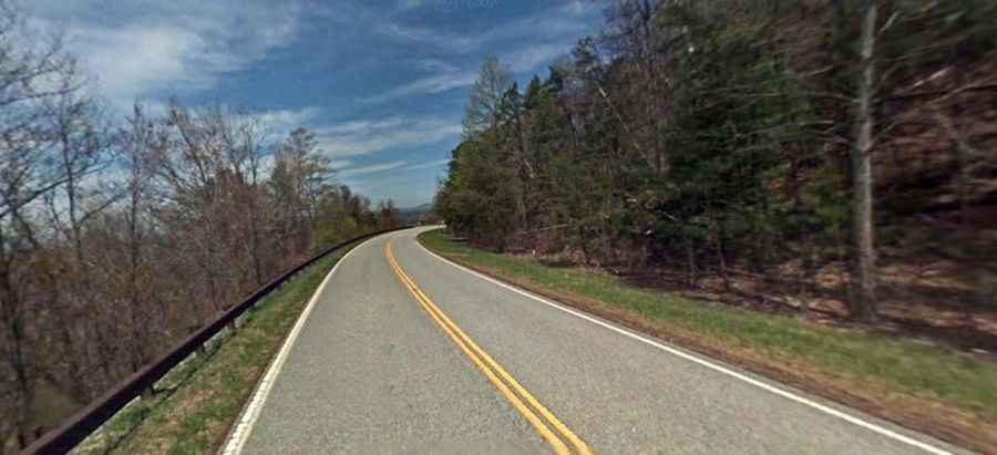
Located to the south of the iconic Tail of the Dragon, the mile-high ride is always a new and unforgettable experience. It is a beautiful and hidden drive through the mountains with lots of scenic overlooks. With long and sweeping corners, it's a favorite for motorcycle and sports car drivers. It can be desolate at night and extremely dangerous in the winter months. It is a 2-laned road with wide shoulders and 15 scenic overlooks.
How long does it take to drive the Cherohala Skyway?
Tucked away in the southeastern United States, the road winds through forests of hardwoods and evergreens. Remember to bring your camera and make sure you leave enough time to make plenty of stops along the way. You can complete the drive in two to three hours, without stops, but take your time. The Cherohala Skyway offers amazing views of mountains, foliage, and waterfalls. It’s a beautiful stretch of road, an easy drive, and right in the middle of some of the most beautiful landscapes in the southern Appalachian Mountains.