Lolo Pass on Montana-Idaho border: curves next 99 miles
Lolo Pass is a high mountain pass at an elevation of 1,598m (5,242ft) above sea level, located on the border of Montana and Idaho, in the USA.
Is Lolo in Idaho or Montana?
The pass is situated on the border between Montana (Missoula County) and Idaho (Idaho County).
How long is the road to Lolo Pass?
The pass road is 215km (134 miles) long, running east-west from Lolo (in Missoula County) to Kooskia (in Idaho County). With few guardrails and sharp turns that seem to pop up out of nowhere, the road through the pass offers a dizzying experience that demands the absolute attention of any driver willing to test the mettle of its asphalt. There are very few services along this route.
Is the road to Lolo Pass in Montana/Idaho paved?
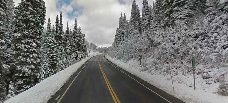
Set high in the Bitterroot Range of the northern Rocky Mountains, the road to the summit is entirely paved. It’s called Highway 12 (Lewis and Clark Highway) and is renowned as one of America’s 15 Best Motorcycling Roads. You've likely seen the photos of the sign that reads "Curves next 99 miles." It’s one of the best motorcycle roads in the country, with plenty of sweeping curves and a few tight ones. There is little traffic and an excellent road surface. This two-lane highway has speed limits of 50 miles per hour or less, with few turnouts and limited opportunities to pass. The road teases you, starting with gentle sweeping turns, building your confidence and urging you to go faster. The scenery, the curves, and the good road surface continue relentlessly. As your endurance wanes, some turns have a closing radius.
How long does it take to drive to Lolo Pass?
Plan about 3 hours to complete the drive without any stops. The drive offers views of gorgeous meadows, mountain peaks, and forested hills. It’s one of the most beautiful sections of the Lewis & Clark Trail as it winds through the Rocky Mountains of Idaho and Montana. This pass played a role in the Lewis and Clark Expedition's journey across the continent. Read more about their discoveries and the routes that became today's roads: From Expedition Routes to Asphalt: Lewis and Clark's Mountain Pass Discoveries.
When was the road through Lolo Pass built?
Tucked away in the Nez Perce-Clearwater National Forest, the high mountain road to the summit was completed in 1962.