Driving The Iconic Taylor Highway in Alaska
Taylor Highway is a very a scenic drive running through the Southeast Fairbanks Census Area in the US state of Alaska, known for its history of gold mining. It’s one of the highest roads in Alaska.
When was the Taylor Highway built?
Constructed between June 1946 and October 1953, the Taylor Highway is a historic route associated with gold mining.
How long is the Taylor Highway?
The road is 249 km (155 miles) long, running south-north from Tetlin Junction on AK-2 road to Eagle, near the Canada–US border.
Is the Taylor Highway open?
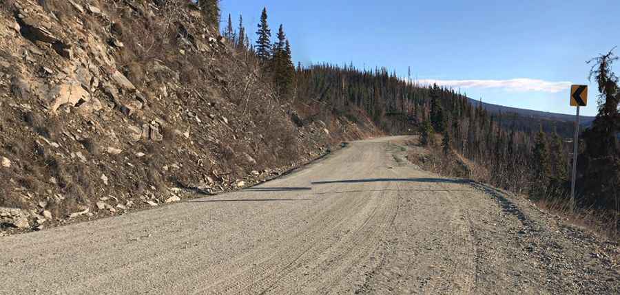
The highway, also known as Alaska Route 5, is closed to automobile traffic from October through April. Travelers should check with car rental agencies as not all vehicles are permitted. Caution is advised, especially on its hairpin bends. The road tops out at 1,138m (3,733ft) above sea level, near the junction with Top of the World Highway, at Jack Wade.
Is Taylor Highway in Alaska paved?
While the first 60 miles (97 km) are paved, the terrain is mostly gravel with steep, narrow gradients and considerable gaps between service points. Sections beyond milepost 64 are unpaved, with some areas damaged by frost. Travelers must navigate through varying road conditions, from good to poor, and be aware of potential washouts. The highway becomes narrower and more winding beyond Jack Wade Junction, demanding careful attention.
Is the Taylor Highway remote?
The Taylor Highway is remote with minimal traffic and limited services. Travelers should ensure they have enough fuel and use dump stations before starting the journey. Services are sparse, primarily available in Tok, Chicken, and Eagle.
Pic: Ea Duvall