What are the highest roads in California?
California, the Golden State, is a land of extreme contrasts—far more than glitzy Hollywood glamour, sun-kissed beaches, and breathtaking coastal cliffs. Tucked away in its immense, geographically diverse eastern half, this wonder conceals an adventurer's paradise. Rising majestically are the towering Sierra Nevada and other rugged mountain ranges, hosting peaks that soar above 13,000 feet.
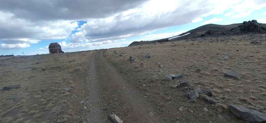
These lofty heights, often draped in a pristine blanket of snow throughout the winter months, are home to some of the most challenging, exhilarating, and incredibly scenic roads in America. As you venture higher, the air thins and the route demands respect, transforming your drive into a thrilling journey across the absolute highest, most memorable roads of California.
Highest roads in California
| Mountain Pass | Elevation | County | Surface |
|---|---|---|---|
| White Mountain Peak | 4.347m (14,261ft) | Mono | Gravel |
| Barcroft Field Station | 3.800m (12,470ft) | Mono | Gravel |
| Sheep Mountain | 3.626m (11,896ft) | Mono | Gravel |
| Mount Morgan | 3.619m (11,873ft) | Inyo | Gravel |
| Mount Patterson | 3.560m (11,679ft) | Mono | Gravel |
| Coyote Ridge | 3.492m (11,456ft) | Inyo | Gravel |
| Patriarch Grove | 3,455m (11,335ft) | Inyo | Gravel |
| Brackett Prospect | 3.368m (11,049ft) | Inyo | Gravel |
| Mammoth Mountain | 3.364m (11,036ft) | Madera | Gravel |
| Dunderberg Peak | 3.348m (10,984ft) | Mono | Gravel |
| Silver Peak | 3.311m (10,862ft) | Inyo | Gravel |
| Big Sam | 3.298m (10,820ft) | Tuolumne | Gravel |
| Campito Mountain | 3.294m (10,807ft) | Mono | Gravel |
| Rocky Bottom Lake | 3.280m (10,761ft) | Inyo | Gravel |
| Leavitt Lake | 3.246m (10,649ft) | Mono | Gravel |
| Round Mountain | 3.216m (10,551ft) | Inyo | Gravel |
| McGee Mountain | 3.204m (10,511ft) | Mono | Gravel |
| Baker Creek Meadow | 3.185m (10,449ft) | Inyo | Gravel |
| Funnel Lake | 3.176m (10,419ft) | Inyo | Gravel |
| County Line Hill | 3.173m (10,410ft) | Mono | Gravel |
| Belfort ghost town | 3.136m (10,288ft) | Mono | Gravel |
| Deadman Pass | 3.129m (10,265ft) | Madera | Gravel |
| Rock Creek Road | 3.121m (10,239ft) | Inyo | Asphalt |
| Upper Summers M. | 3.110m (10,203ft) | Mono | Gravel |
| June Mountain | 3.092m (10,144ft) | Mono | Gravel |
| Mount Givens | 3.091m (10,141ft) | Fresno | Gravel |
| Saddlebag Lake | 3.091m (10,141ft) | Mono | Gravel |
| Crooked Creek Stn. | 3.090m (10,150ft) | Mono | Gravel |
| Horseshoe Meadow | 3.070m (10,072ft) | Inyo | Asphalt |
| Laurel Lake | 3.065m (10,058ft) | Mono | Gravel |
| Coyote Flat | 3.061m (10,042ft) | Inyo | Gravel |
| Potato Peak | 3.060m (10,039ft) | Mono | Gravel |
| Rogers Peak | 3.049m (10,003ft) | Inyo | Gravel |
| Rainbow Summit | 3.046m (9,993ft) | Mono | Gravel |
| Monument Peak | 3.040m (9,973ft) | El Dorado | Gravel |
| Tioga Pass | 3.031m (9,943ft) | Mono | Asphalt |
| Mount Patterson radio | 3.027m (9,931ft) | Mono | Gravel |
| Sherman Peak | 3.022m (9,914ft) | Tulare | Gravel |
| Summit Drive | 3.000m (9,842ft) | Mono | Asphalt/Gravel |
| South Lake | 2.999m (9,839ft) | Inyo | Asphalt |
| Virginia Lakes | 2.993m (9,819ft) | Mono | Asphalt |
| White Bark Vista | 2.993m (9,819ft) | Fresno | Gravel |
| Station Peak | 2.967m (9,734ft) | Mono | Gravel |
| Hawkins Peak | 2.953m (9,688ft) | Alpine | Gravel |
| Sonora Pass | 2.939m (9,642ft) | Mono, Tuo., Alp. | Asphalt |
| Swamp Lake | 2.929m (9,609ft) | Fresno | Gravel |
| Lobdell Lake | 2.908m (9,540ft) | Mono | Gravel |
| East Peak | 2.893m (9,491ft) | El Dorado | Gravel |
| Iron Mountain | 2.892m (9,488ft) | Inyo | Gravel |
| Mazuorka Peak | 2.870m (9,416ft) | Inyo | Gravel |
| North Lake road | 2.854m (9,363ft) | Inyo | Asphalt/Gravel |
| Bald Mountain | 2.847m (9,339ft) | Tulare | Gravel |
| Bodie Masonic Road | 2.831m (9,288ft) | Mono | Gravel |
| Masonic Mountain | 2.812m (9,225 ft) | Mono | Gravel |
| Cerro Gordo FAA site | 2.811m (9,222ft) | Inyo | Gravel |
| Onion Valley Road | 2.810m (9,219ft) | Inyo | Asphalt |
| Kaiser Pass | 2.803m (9,196ft) | Fresno | Asphalt |
| Sherman Pass | 2.800m (9,200ft) | Tulare | Asphalt |
| Minaret Summit | 2.797m (9,175ft) | Madera | Asphalt |
| Lake Sabrina | 2.796m (9,173ft) | Inyo | Asphalt |