How to Travel the Mount Nebo Scenic Byway in Utah
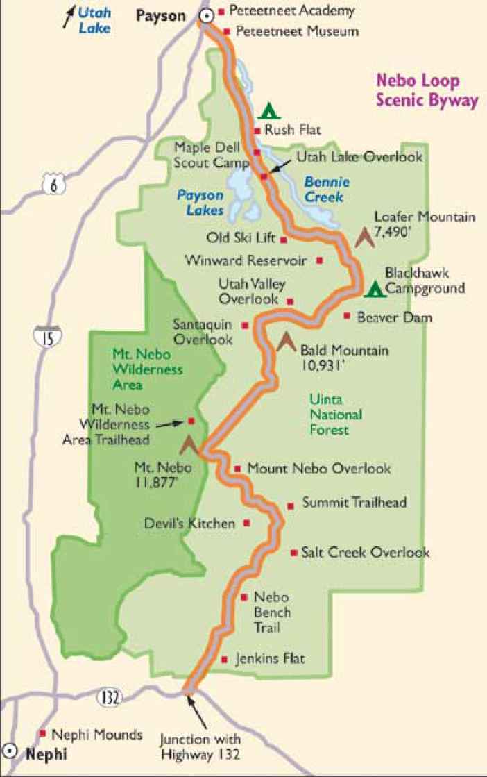
Mount Nebo Scenic Byway (Nebo Loop) is a drive with rewarding views located in the Uinta National Forest, in the US state of Utah. The road tops out at 2,850m (9,353ft) above sea level at the Monument trailhead. It’s a mountain road with spectacular views of the Wasatch Range.
How long is the Mount Nebo Scenic Byway?
The road is 56 km (35 miles) long, winding through the southern end of the Wasatch Range. It’s totally paved and runs between the cities of Nephi (in Juab County) and Payson (in Utah County). Stay on your side of the road except while crossing into a pullout. Watch for opposing traffic, cattle, and large wildlife on the road. Eventually, the road climbs out of the canyon on its way towards Mt. Nebo.
How challenging is driving the Mount Nebo Scenic Byway?
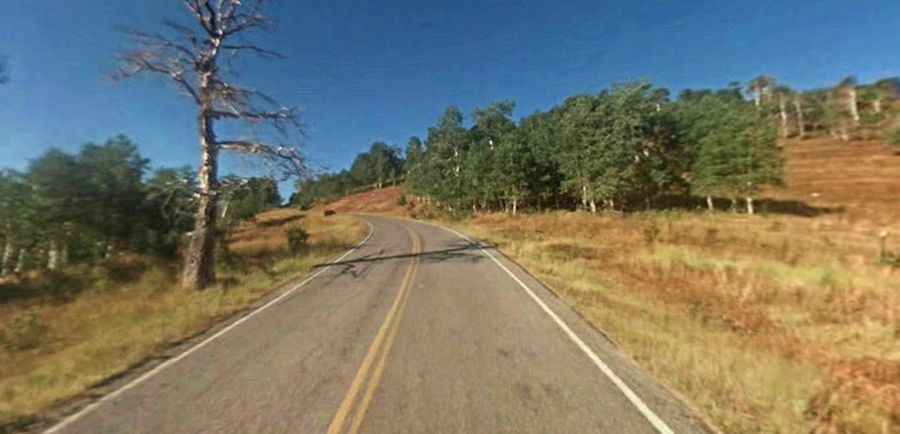
The Civilian Conservation Corps (CCC) built the Mount Nebo loop road, starting in 1933. The road is paved and smooth, but certain sections of the highway are narrow and have steep drop-offs. This is a mountain road with lots of sharp winding turns and no guardrails, so use extra caution when driving on it, especially at night. It has plenty of switchbacks to keep your handlebars turning. Also, keep your engine challenged with a good deal of climbing, and your brakes might be smoking after racing down some of the fast descents.
Is the Mount Nebo Scenic Byway open?
The byway is a two-lane road in mountainous terrain, topping out at 2,850m (9,353ft) above sea level at the Monument trailhead. Always check the weather forecast before you start your journey: adverse conditions are common. Due to heavy snow, the road closes in the winter from late October through June or July, and like any mountain road, it can experience severe weather changes. In colder weather, watch for icy conditions in shaded or snowmelt areas.
How long does it take to drive the Mount Nebo Scenic Byway?
The road, known as Forest Road FR 015, is very scenic and has breathtaking views of the Wasatch Range, with many overlooks and wildlife viewing opportunities. Plan 1.5 hours to drive without any stop. The road starts out in a narrow canyon following a trout stream as it finds its way through the canyon. It is a photographer's dream. Middle and upper elevation wildflowers are common and diverse in summer, especially on side roads joining the main paved road. Several campgrounds and many trailheads and scenic view pullouts are found along the byway. The road climbs 9,000 feet and crosses the Uinta-Wasatch-Cache National Forest, providing stunning views of Utah Valley, the surrounding Wasatch, and dramatic vistas of 11,928-foot Mt. Nebo, the highest peak in the Wasatch Range. Don’t be distracted by the scenery while driving.