Sitgreaves Pass in Arizona is a fabulous road if you are not scared of heights
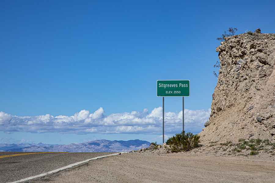
Sitgreaves Pass is a mountain pass at an elevation of 1,096m (3,595ft) above sea level, located in Mohave County, in the U.S. state of Arizona. Very few guardrails give you no leeway for error.
Where is Sitgreaves Pass?
The pass is located between Kingman and Oatman, in the northwestern corner of Arizona, high in the Black Mountains.
Why is it called Sitgreaves Pass?
The pass was named for Captain Lorenzo Sitgreaves, of the Corps of Topographical Engineers.
How long is Sitgreaves Pass in Arizona?
The road to the summit is entirely paved. It’s called Oatman Road, part of Historic U.S. 66 W. The pass is 35.40km (22 miles) long, running from Oatman to Walnut Creek. The summit is about 3 miles west of Ed's Camp.
Is the road to Sitgreaves Pass dangerous?
The road is pretty narrow, very curvy, with lots of blind hairpin turns and no shoulders. It’s a fabulous drive if you are not scared of heights or of tumbling down a mountainside. In many places, there are only a few wooden fence posts and a piece of chain between you and the drop over the edge of the mountain. Make sure to look for the old cars off the road near the hairpin curves. This road is built like a bobsled run, with crazy switchbacks and steep drop-offs plunging thousands of feet down. It is slow going, with some of the winding sections slowing down to 20mph. The road is steep, hitting a 12% maximum gradient through some of the ramps. You'll be fine in normal vehicles, but larger RVs are going to have serious issues. Don’t take this road in bad weather, and do not attempt it after dark.
Is the road to Sitgreaves Pass in AZ worth it?
Plan about 45 minutes to complete the drive without any stops. However, the drive will take longer due to its beauty. Take your time; it's well worth the drive. There are plenty of pull-offs for you to get out and take pictures, so don't try to take pictures while you are driving. A lot of mining took place along the stretch of road between Oatman and Cool Springs. There are some historical buildings, or rather remains of historical buildings, along this route.
Image credit: Depositphotos