The Wild Road to Sand Creek Pass in Colorado
Sand Creek Pass is a high mountain pass at an elevation of 2,741m (8,992ft) above sea level, located in Larimer County, in the US state of Colorado.
Where is Sand Creek Pass?
The pass is located in the north-central part of Colorado, near the Wyoming border, within the Roosevelt National Forest.
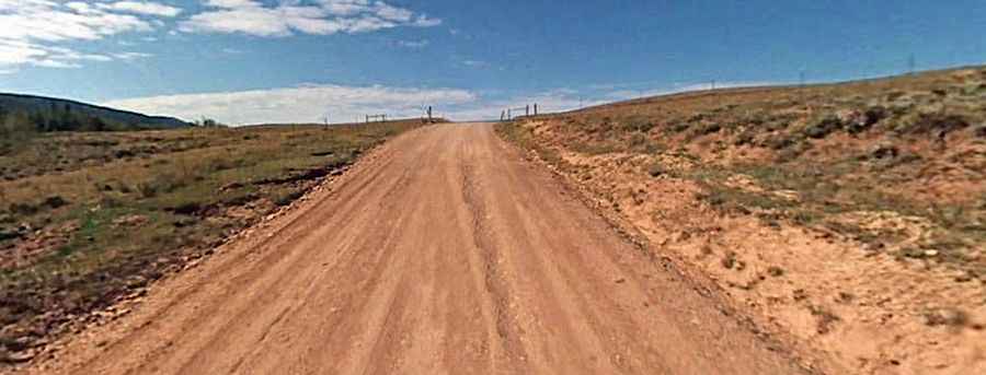
Is Sand Creek Pass unpaved?
The road to the summit is totally unpaved. It’s called Sand Creek Road (County Road 80C). The trail is pretty easy and suitable for stock SUVs. The road contains one water crossing that can be up to a foot deep during the spring snow melt.
How long is Sand Creek Pass?
The pass road is 14 km (8.69 miles) long, running from County Road 103 to Wapiti Way.
Road Conditions and Difficulty
The south half of the trail is fairly flat. However, after the creek crossing, the road becomes narrow, rough, and steep in places, beginning a long, scenic descent to Larimer County Road. The route is optimal for stock, high-clearance vehicles and drivers with little to no off-road experience.
Seasonal Attractions
The area is very popular in the fall with deer and elk hunters setting up camp for their adventure. Wildflowers were abundant on the north side when driven in mid-July. It is also a popular OHV area due to plentiful dispersed camping and many fun side roads to explore.
Is Sand Creek Pass open in winter?
The road, running through the beautiful Ponderosa Pines, is closed from December 1 to June 14.