Pearl Pass is one of the last roads to open in Colorado
Pearl Pass is a high mountain pass at an elevation of 3,878m (12,723ft) above sea level, located in the U.S. state of Colorado. It's one of the highest roads in Colorado.
Where is Pearl Pass?
The pass is located on the boundary between Pitkin and Gunnison counties, in the eastern part of Colorado.
Can you drive Pearl Pass?
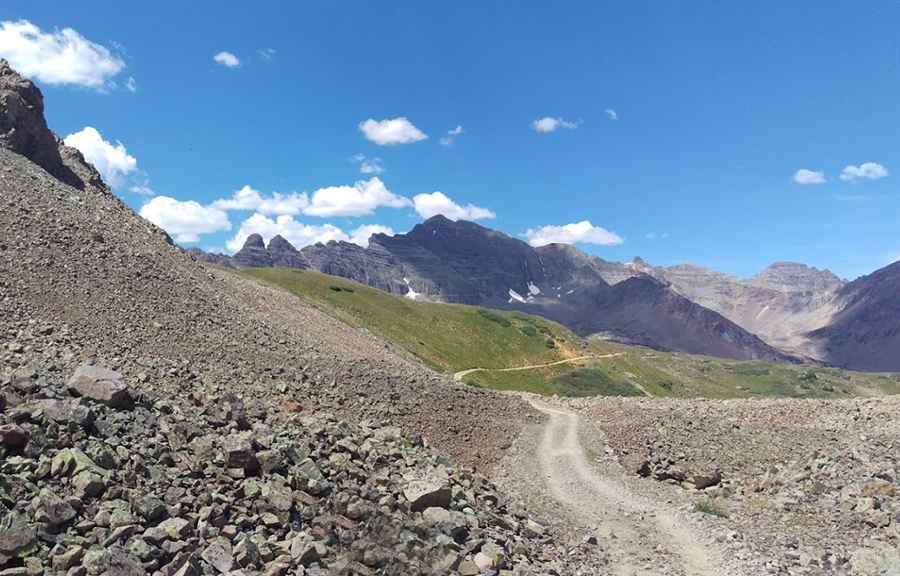
The road to the summit is entirely unpaved. It’s called Pearl Pass Road (#102). It’s an old mining road running from Crested Butte to Aspen. It’s 16.9 miles (27.19km) long.
How difficult is Pearl Pass?
The road is not for inexperienced jeepers: you definitely need a good 4x4. The road features many boulder fields, steep climbs, water crossings, and narrow shelves. There are sections that are significantly rough, especially a half-mile up a 25+% grade. The road climbs steeply, there are rough, rocky sections, and you'll want to be sure that everyone is wearing a seatbelt. Once over the pass, the route is not terribly demanding except for a section of marsh. This trail has less obstacles than some of the other CO trails, but plenty of rocks, rock slides, and unparalleled scenic beauty.
Is Pearl Pass Colorado Open?
Set high in the Rocky Mountains of Colorado, there is often snow on the road well into late July, and some years the snow does not melt sufficiently to allow passage. The pass is only open a few weeks in late summer due to snow banks blocking the trail. Completing this trail may not be possible during many years because of snow that is very often blocking the trail on the south side of the pass. Snow and ice can be present well into late summer at higher elevations. During years of heavy snowpack, the summit can be blocked for the entire year.
How long does it take to drive Pearl Pass?
The drive is very scenic and offers an unmatched variety of different landscapes. Plan 5-6 hours to complete the drive.
Is Pearl Pass worth it?
Nestled in the Gunnison National Forest, the pass sits between two of the most famous recreational areas in the state: Aspen and Crested Butte. The views are spectacular. It crosses the Continental Divide.
Pic: Tim O'kelly