Baxter Pass: Ultimate 4wd Destination in Colorado
Baxter Pass is a high mountain pass at an elevation of 2.573m (8,441ft) above sea level, located in Garfield County, in the U.S. state of Colorado. High-clearance 4WDs are recommended, though most stock SUVs are acceptable.
When was Baxter Pass in Colorado built?
The pass is located on the way from Dragon (Utah) to Mack (Colorado). A railroad (Uintah Railway) once went up and over the pass to haul gilsonite between both cities. It was built during 1905-1906. The Uintah Railway was unique in that it was built for one product, and gilsonite supported it. During the 1920s and 1930s, the advent of better roads and heavy trucks made the railroad obsolete, and it was finally abandoned in 1938.
Can you drive to Baxter Pass in Colorado?
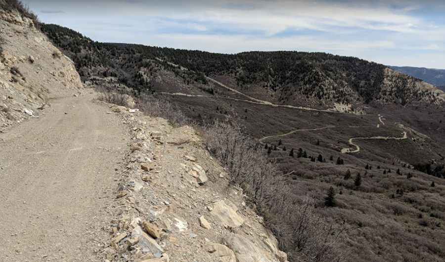
The road to the summit is totally unpaved (hard-packed, sand, a few bumpy places, and rocks larger than 6 inches). It’s called County Highway 201 (Baxter Pass Road). Not recommended for newbies. Along the way, you’ll have to deal with some narrow parts and dangerous drop-offs: a short shelf road section is on the south approach. This is a rough dirt road through a really lonesome, isolated corner of Colorado.
How long is the road to Baxter Pass in Colorado?
The remote road is 81km (50.3 miles) long, running south-north from Mack (in Mesa County, Colorado) to the Utah border, south of Dragon.
Is Baxter Pass Colorado Open?
The winding and steep trail is accessible from June through October. The wind sometimes piled snow up as high as the windows of the passenger cars.
How long does it take to drive through Baxter Pass Colorado?
Plan about 3 hours to complete this remote road. There are a few ghost towns along the way. The summit hosts a communication antenna.
Pic: Mike Driver