Travel guide to the top of Tincup Pass in Colorado
Tincup Pass is a high mountain pass at an elevation of 3,710m (12,171ft) above sea level, located in the U.S. state of Colorado. It is one of the highest roads in Colorado.
Where is Tincup Pass?
The pass, also known as Tin Cup Pass, is located to the west of the Saint Elmo ghost town, on the boundary between Chaffee and Gunnison counties, in the central part of Colorado.
How long is the road to Tincup Pass in Colorado?
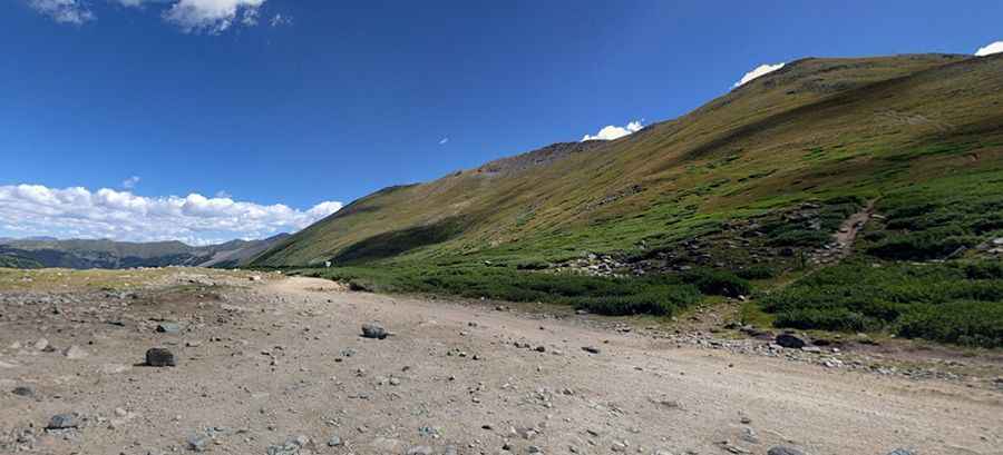
The road to the summit is totally unpaved. It’s called County Road 267. It’s 20.43km (12.7 miles) long, running west-east from Tincup (in Gunnison County) to St. Elmo (a ghost town in Chaffee County founded in 1880).
Is Tincup Pass in Colorado open?
Set high in the heart of the Sawatch Range of Colorado Rockies, the road to the summit is open seasonally from mid-June to early autumn (depending on snow conditions). Because of the high elevation, snow is present on the pass until early July. Always check avalanche conditions before venturing out in the winter.
Is the road to Tincup Pass in Colorado difficult?
The road is suitable for any high-clearance, 4-wheel-drive SUV with low-range gearing. It’s easier from the east. The road is generally in good shape, though steeper portions are eroded with many exposed rocks. The west side of the pass is pretty rough. The trail features a few steep sections and a few narrow areas where two cars can barely pass each other. Near the pass, the trail gets narrow enough to require careful driving, with high cliffs. Rocky at the top with one short section of narrow shelf road at 12,000 feet that often remains snow-covered into early July. The road is usually wide enough for easy passage with oncoming traffic, mostly ATVs.
When was the road to Tincup Pass in Colorado built?
Tucked away in the Gunnison and San Isabel National Forests, the road was built in the late 1800s (1881) as a wagon road to move supplies between the two towns. At the pass, you’ll be on the Continental Divide. The pass is named after a prospector called Jim Taylor, who in 1860 brought his gold strike back to camp in his tin cup.
How long does it take to do Tincup Pass?
The road is very scenic and offers beautiful high alpine views. Plan a 2-3 hour ride with stops to complete the drive. It is one of the most popular 4-wheel-drive destinations in the region. The lower parts of the road go through an aspen forest. It’s a very popular route for four-wheel enthusiasts during the summer months with stunning views of the rugged mountains. There are plenty of places to pull over for photographs. Note the wildlife that may be in the vicinity, including marmots that live among the rocks. The road leads to the blue Mirror Lake.
Pic: Dan Vielhaber