A Most Tricky Scenic Drive to Gunsight Pass in Colorado
Gunsight Pass is a high mountain pass at an elevation of 3.692m (12,112ft) above sea level, located in Gunnison County, in the U.S. state of Colorado. This high alpine road is brutal and going through some severe erosion so use caution. It's one of the highest roads of Colorado.
Where is Gunsight Pass?
The pass is located in the western part of Colorado, within the Gunnison National Forest
How long is the road to Gunsight Pass in CO?
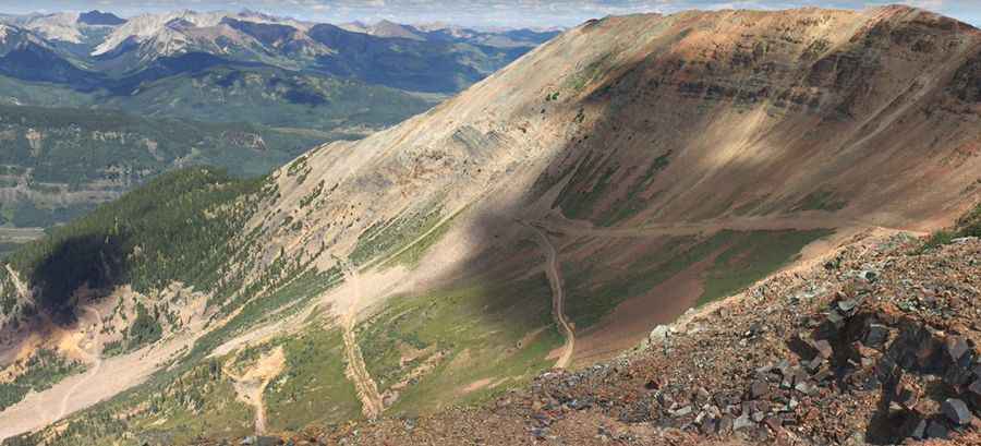
The road to the summit is totally unpaved with loose rocks. It’s called Gunsight Pass Road, also known as Trappers Way. It’s an old mining road through Wolverine Basin with many switchbacks that gets you up on the flank of Mount Emmons. Starting at Crested Butte, the road is 11.90km (7.4 miles) long. The drive offers great views of Crested Butte on the lower part of the trail and spectacular northern views as you climb.
Can I drive to Gunsight Pass in CO?
There is no way to actually drive over the pass, or even to the top of the pass. The last two large switchbacks of this trail are closed to ATV’s and 4×4′s because it is no longer safe to drive on. So if you are looking to get up to or over the pass, you will need to use a mountain bike or plan on a bit of hiking. This old road is not well maintained. The past years, the shale slope that leads to the top is currently experiencing major erosion, which causing various landslides to block the road. The upper section of the road on the south side of the pass has also degraded along a scree slope to the point where it is not passable safely.
Is the road to Gunsight Pass in CO open?
Set high in the Sawatch Range of the Rocky Mountains of Colorado, the road to the summit is impassable from November to May, weather permitting. This is a difficult drive. Be prepared for the risks of thunderstorms, cold weather, and isolation. Snowfields can be dangerous; you can fall through them to rocks below. Be careful.
Is the road to Gunsight Pass steep?
Located to the west of Mt Emmons and Red Lady Summit, the road to the summit is very steep, hitting an 18% of maximum gradient through some of the ramps. Starting at Crested Butte, the elevation gain is 981 meters. The average gradient is 8.24%.
Pic: Eric Yackel