A steep paved road to Tejon Pass in California
Tejon Pass is a high mountain pass at an elevation of 1,268m (4,160ft) above sea level, located in Kern County, in the U.S. state of California.
Why is it called Tejon?
In Spanish, 'Tejón' translates to 'badger.' Tejon Pass received its name in 1806 when Lt. Francisco Ruiz, a missionary explorer, stumbled upon a deceased badger near the mouth of the canyon during an expedition into the San Joaquin Valley.
Where is Tejon Pass?
The pass is located in the southern part of California, linking the Central Valley and Southern California.
Is the road to Tejon Pass in California paved?
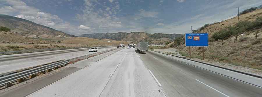
The road to the summit is entirely paved. It’s called Interstate 5, and it’s the northern gateway from Los Angeles to the rest of California. The drive includes steep sections. Due to its steepness, near the summit, there are two runaway truck ramps.
How steep is Tejon Pass?
The pass represents the highest point on the highway in the state and is often referred to as the Grapevine. However, the Grapevine more accurately denotes the steep 5 1/2 mile grade section at the northern end of this pass, where the grade is 6% for 5 miles. The pass features a gradual rise from its southern approach but a precipitous descent through Grapevine Canyon toward the San Joaquin Valley on the north. Northbound I-5 from Tejon Summit has a vertical descent of 2,613 feet over 11.6 miles. The grade is steep for the first 2 to 3 miles, then it lessens significantly before reaching the very steep grade section called the Grapevine Hill at 6.5 miles north of the summit. Southbound I-5 from the Tejon Summit consists of approximately 22 miles of rolling hills before starting a steep descent down the "5-mile grade." The 5-mile grade has a vertical descent of 1,603 feet over a total of 7.5 miles. There is an uphill section just before reaching the 5-mile grade where there is a large brake check area for trucks.
How long is Tejon Pass?
The pass road spans 122km (76.3 miles), running north-south from Bakersfield (in Kern County) toward Santa Clarita (in northwestern Los Angeles County).
Is the road to Tejon Pass in California open?
The weather in this zone is harsh and highly unpredictable, and it doesn't take much time for bright sunshine to change over to moderate to heavy snowfall. While the pass is sunny in the summer, spring, and fall, it is subject to severe weather and may be closed to traffic in the winter. The road is perilous due to icy conditions combined with the steep grade of the pass and high traffic during the winter holidays.
Road suggested by: Marcus Smith