Driving through the challenging River Road in TX
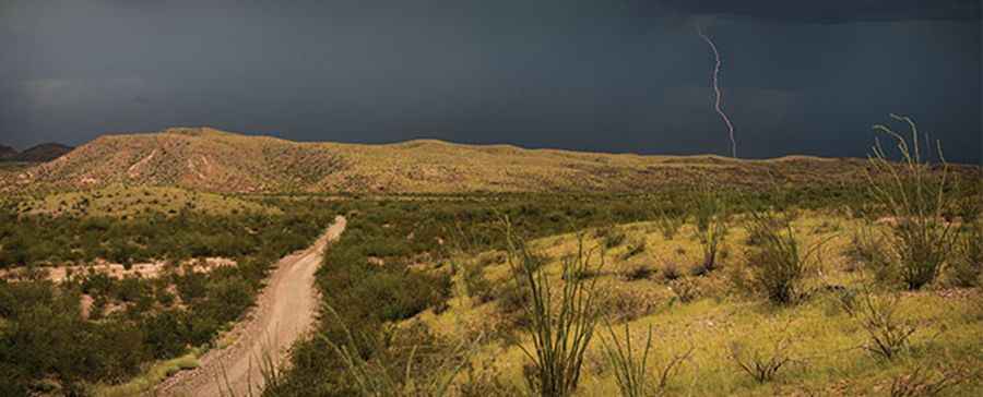
River Road is a very scenic 4x4 trail located in Brewster County, in the western part of the U.S. state of Texas. It’s said to be one of the most scenic drives in Texas. The road is pretty challenging, as it travels through and across many desert washes.
How long is the River Road?
Set in the Big Bend National Park, the road is 82.07km (51 miles) long spanning the remote southern portion of the park, generally following the course of the Rio Grande. It roughly connects the areas near Rio Grande Village and Castolon. The western portion is less traveled and more rugged. Primitive roadside campsites (permit required) located along the road, allow for extended exploration. The west end is lesser used, and generally in a rougher condition. River Road crosses numerous washes; it is often impassable after rains. While generally following the course of the Rio Grande, the road runs a considerable distance from the river, especially in its mid-section near Mariscal Mountain. Do not attempt this drive without a high-clearance vehicle.
How long does it take to drive the River Road?
After rain, even a single rainfall, conditions of the road can be challenging. Adverse weather conditions can prompt closure of the road. Due to its length and usually rough road conditions, allow a full day to drive from end to end. Due its unique location and passing through remote areas, it is important when driving in these conditions to be prepared. Along the way are many side roads, backcountry campsites, trail-heads to some of the park's most isolated areas (including the Mariscal Canyon Trail), and sections of the park most visitors never see.
Pic: http://induced.info/?s=Big+Bend+Made+Easy++Texas+Monthly