Burro Wash Road is a scenic 4x4 trail in Nevada
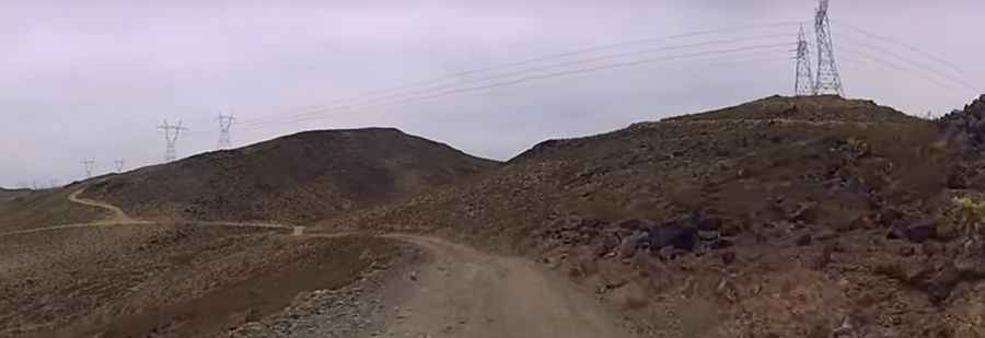
Burro Wash Road is a scenic drive located in Clark County, in the US state of Nevada. The trail is a power line road that generally follows the Burro Wash canyon.
Where is Burro Wash Road?
The road is located in southern Nevada, near the Arizona border, to the south of Hoover Dam.
How Long is Burro Wash Road and What Can I See?
The trail is 18.50km (11.5 miles) long. Starting at Boulder City (a city in Clark County), it ends at the Colorado River on Burro Wash. This scenic route initially runs along the power lines before passing through Black Canyon and traveling down a wash. At the end of the trail, you’ll have great views of the river and a small beach to enjoy the cool water.
Do I Need a 4x4 to Drive Burro Wash Road?
Yes, Burro Wash Road is rough and rocky, requiring a high-clearance 4x4 vehicle. Conditions change frequently due to weather, flash floods, and rockfall. The trail includes minor washed-out areas, off-camber spots, and rocky obstacles, but is generally moderate. Always check weather reports to avoid flash floods.
What Terrain Challenges Can I Expect on Burro Wash Road?
The trail starts as a sandy wash and soon includes extreme rocky sections requiring careful wheel placement. Near the end, you'll face rocky descents, sandy washes, and minor rock obstacles before reaching the river. Most 4-wheel drive vehicles with low-range gears and all-terrain tires should manage, but exercise caution, especially on the washed-out downhill sections.
What Precautions Should I Take When Traveling Burro Wash Road?
Parts of the trail are high clearance and rocky. Conditions can change drastically after heavy rain. Navigate carefully on the winding and steep sections. Springtime camping may be uncomfortable due to flying bugs, and rattlesnakes are present in the area. Cellphone service is largely unavailable, so it's best to be prepared and, if possible, travel in groups.
Pic&video: Mike Teliska