Driving the Main Divide Road to Santiago Peak in California
Santiago Peak is a high mountain peak at an elevation of 1,734m (5,689ft) above sea level, located in the U.S. state of California.
Where is Santiago Peak?
The peak is located on the boundary between Orange and Riverside counties, in the southern part of California, within the Cleveland National Forest.
Why is it called Santiago Peak?
The peak, Orange County's highest summit, is named after Santiago Creek, which begins on its southwestern slope.
Can you drive to Santiago Peak in California?
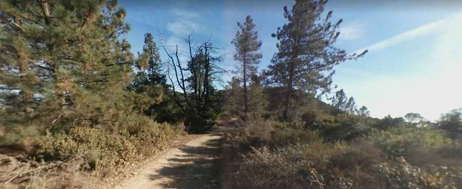
The road to the summit is totally unpaved. It’s called Main Divide Road. This is a fairly simple trail, though narrow with some loose, uneven surfaces. Your stock 4WD should do a good job here, but most SUVs or trucks could drive the trail with no problem.
Is the road to Santiago Peak in California steep?
The road to the summit is very steep, hitting a 22% maximum gradient through some of the ramps. Starting at Ortega Highway, the ascent is 24.94km (15.5 miles) long. Over this distance, the elevation gain is 1.006 meters. The average gradient is 4.03%.
Is the road to Santiago Peak in California open?
Set high in the Santa Ana Mountains, to the south of Modjeska Peak, the road is subject to closure depending on weather and fire danger level. During some winters, snow has fallen on the peak.
Is the road to Santiago Peak in California worth it?
The drive offers stunning views spanning from Catalina Island to Orange and Riverside counties. On a clear day, when you reach the summit, you will have views clear out to the ocean (sometimes even Catalina Island) and all the way out to the San Jacinto mountains and Orange and Riverside counties at the same time.
What’s on the top of Santiago Peak in California?
The top of the peak is crowned with many microwave and telecommunication antennas. It provides radio coverage over much of Los Angeles, Orange, San Bernardino, Riverside, and San Diego counties. The peak is frequently referred to as Saddleback Mountain by locals.
How long does it take to get to the top of Santiago Peak?
To drive the backcountry road without stopping will take most people between 1.5 and 2 hours.
Pic: Joel Sartain