How to get by car to the scenic Juniper Lake in California?
Juniper Lake is a picturesque mountain lake at an elevation of 2,094m (6,870ft) above sea level, located in the U.S. state of California.
Where is Juniper Lake?
The lake is located on the boundary between Plumas and Lassen counties in the northeastern portion of California, at the southeast corner of Lassen Volcanic National Park. There is a campground and a ranger station located on the eastern shore of the lake.
How long is the road to Juniper Lake?
The road to the lake is called Juniper Lake Road. Surrounded by beautiful mountains and lakes, the road is 20.92km (13 miles) long. It ends in a parking lot, on the northern shore of the lake.
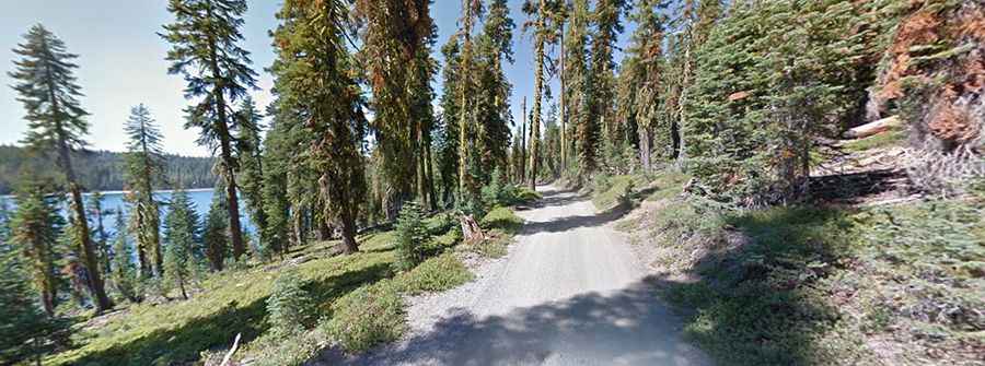
Is the road to Juniper Lake paved?
The road is pretty well maintained. It is paved for the first 6 miles north of Chester (Highway 36). It turns into a narrow, rough, and dusty dirt road for the remaining 7 miles, but it doesn't require 4WD or high clearance in dry weather. It’s a winding, hairy drive, in some places only wide enough for one vehicle.
Can I drive my vehicle to Juniper Lake?
Some passenger cars make it. The road is not suitable for RVs, trailers, or vehicles with very low clearance. The final half mile down is steep and narrow.
Is the road to Juniper Lake open?
Set high in the Sierra Nevada of California, the road is subject to seasonal closures and is usually closed from November to May.