A Delightful Yet Challenging Drive to Mount Lassen in California
Lassen Peak is a high mountain pass at an elevation of 2,604m (8,543ft) above sea level, located in Shasta County, in the U.S. state of California.
Where Is Mount Lassen?
The pass is located between Redding and Susanville, in the northern part of California, within the Lassen Volcanic National Park.
Is Mount Lassen Paved?
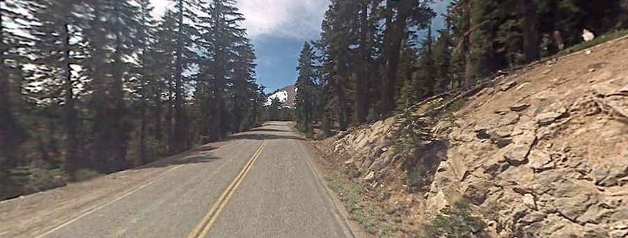
The winding road to the summit is fully paved, with many curves and twists. It’s called Lassen Volcanic National Highway. The road is part of the California State Route 89 and was built in 1926.
How Challenging Is the Road to Mount Lassen?
The road is not recommended for vehicles longer than 45 feet in total length. Running through mountainous terrain, watch for wildlife and falling rocks. The southern section of the highway is windy and includes a handful of switchbacks. There are no guardrails on this route due to snow removal requirements.
How Long Is the Road to Mount Lassen?
The pass is 54.71km (34 miles) long, running northwest-southwest from CA-44 (Manzanita Lake) to CA-36.
Is the Road to Mount Lassen Open in Winter?
Set high in the Cascade Range, at this elevation, it is the highest point of the road. The mountain road is closed in winters. Clearing of the main park road (30 miles total) begins in April and on average takes 2 months before the road opens through. The road can close intermittently with inclement weather.