Driving the Mount Lowe Fire Road in California
Mount Lowe Fire Road is a gravel fire trail located in Los Angeles County, in the U.S. state of California. The road is unsafe for travel and closed to motorized vehicles.
Why is it called Mount Lowe?
It is named after Professor Thaddeus S.C. Lowe.
When was Mount Lowe Fire Road built?
This steep fire road was graded over an old railway right-of-way, which was created as a scenic tourist line to bring visitors to see Mount Lowe and Echo Mountain. The railway opened in 1893 and stopped services in 1938, after a horrendous rain washed most everything off the mountain sides.
How long is Mount Lowe Fire Road?
The road is mostly unpaved. It’s 13.67km (8.5 miles) long running from the paved Brown Mountain Truck Trail to the paved Mt Wilson Red Box Road. The road is very steep, hitting a 20% of maximum gradient.
Is the Mount Lowe Fire Road worth the drive?
Tucked away in the southern part of California, the trail is also known as East Cuesta ridge road. It offers access to the ruins at Echo Mountain and the Alpine Tavern. The trail is littered with interesting Americana and remnants from the past. On the road you can still ride through an old tunnel, see old bridges, and even the ruins of some of the hotels. Mount Lowe Fire Road is the access to the climb of several peaks on the zone: San Gabriel Peak (6,161 ft), Mt. Disappointment (5,963 ft), Mt. Deception (5,796 ft), Mt. Markham (5,728 ft) and Mt. Lowe (5,574 ft). The lower section of road is paved, once past Mount Lowe Railway Trail it is dirt.
Can you drive on Mt Lowe Road?
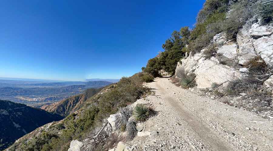
Set high in the southern fold of the San Gabriel Mountains, the trail is quite sinuous as snakes through the Angeles National Forest, offing superb views of the mountain, canyons and surrounding pine forests. The road is closed to motorized vehicles, blocked by a barrier on both entrances, and is driven by trail crews and other administrative users only. One of the most famous sections of the trail is Mueller Tunnel. The last half mile is usually not passable to vehicles and goes through the tunnel ending at Eaton Saddle. The trail carves its way under the precipitous south face of San Gabriel Peak.
Pic: Paulo Branicio