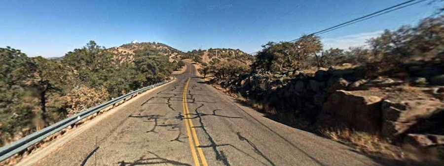
The road to the summit of Mount Locke in Texas
Mount Locke is a high mountain peak at an elevation of 2.070m (6,790ft) above sea level, located in Jeff Davis County, in the U.S. state of Texas. It's one of the highest roads in Texas.
Can you drive to Mount Locke in Texas?
Located in the western part of Texas, the road to the summit is totally paved with steep grades. It’s called Texas State Highway Spur 78 or Spur 78.
What’s the highest elevation at any point on the state highway system?
At its terminus, at the summit of Mt. Locke, Spur 78 has the highest elevation at any point on the state highway system. Snow is unusual in winter. The summit experiences a semi-arid climate with cool, dry winters and hot, wetter summers. No cell reception at all most of the route.
Is the road to Mount Locke in Texas steep?
Tucked away in central Jeff Davis County, just 17 miles from Fort Davis, the road to the summit is pretty steep. Starting at TX-118 road, the ascent is 2.73km (1.7 mile) long. Over this distance the elevation gain is 176 meters. The average gradient is 6.44%, with a maximum gradient of 11,4%.
How do I get to the McDonald's observatory?
Nestled in the majestic Davis Mountains, the winding road leading to the summit came into existence on April 24, 1933. Perched proudly atop this lofty peak lies the renowned McDonald Observatory, an esteemed astronomical facility established in 1932 and presently administered by the University of Texas at Austin. Serving as a preeminent hub for astronomical research, education, and public outreach, it stands as one of the world's foremost institutions in its field. Boasting an array of colossal telescopes, it offers unparalleled opportunities for exploration and discovery. Within the visitor's center, visitors are welcomed by a captivating gift shop showcasing an assortment of astronomy-related merchandise, while the StarDate Cafe tempts the palate with celestial delights. Back in 1932, when the decision was made to establish the observatory on this site, the pinnacle remained nameless. However, it was subsequently bestowed with the moniker "Locke Peak" in honor of G. S. Locke, an early rancher whose contributions were vital to the region.