Mount Greylock is the Highest Road of Massachusetts
Mount Greylock is a mountain peak at an elevation of 1.064m (3,491ft) above sea level, located in Berkshire County, in the US state of Massachusetts.
When was the road to Mount Greylock built?
The road to Mount Greylock was built by the CCC (Civilian Conservation Corps) between 1906 and 1907.
Can you drive up Mount Greylock?
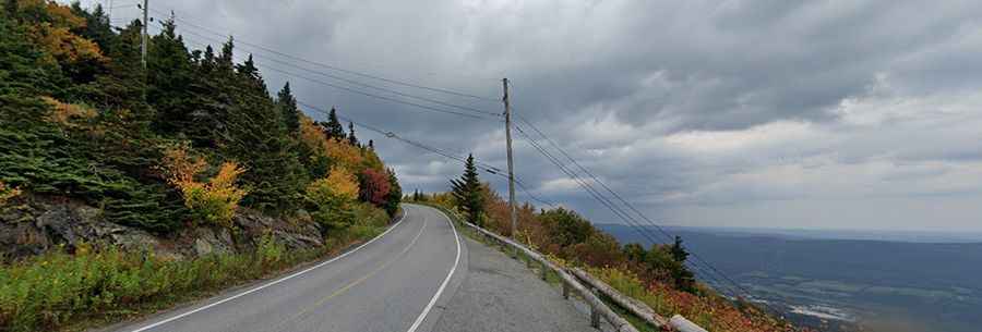
The road to the summit is fully paved with a few hairpin turns. It’s called Rockwell Road.
What is at the top of Mount Greylock?
It is the highest point in Massachusetts. At the summit you can find the Massachusetts Veterans War Memorial Tower and a television and radio tower.
Is Mount Greylock Open?
Set high in the Taconic Mountains, the road opens annually from late May through November 1st. Vehicles greater than 22 feet in length are prohibited from travelling to the summit.
Is Mount Greylock worth it?
Located on the western edge of Massachusetts, the drive up takes you through thick alpine forest and eventually to fantastic overviews of the valley below. From its peak on a clear day, you can see as far as 90 miles away. The summit features a fantastic panorama offering dramatic views of five states.
How long is the road to Mount Greylock?
The road to the summit is 14.6km (9.1 miles) long, starting in Lanesborough, near the NY border. If you’re coming from the north side of the mountain, there’s another road to the summit, called Notch Road.