Discover the Sierra Vista Byway: A Scenic 83-Mile Drive through the Sierra Nevada Mountains in California
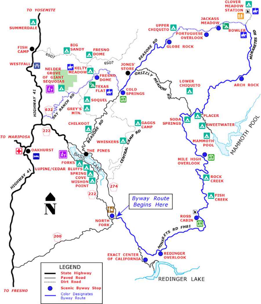
Sierra Vista Byway is a very scenic drive meandering for 83 miles through outstanding scenery with remarkable views of the crest of the Sierra Nevada Mountains, in the U.S. state of California.
How long is the Sierra Vista Byway?
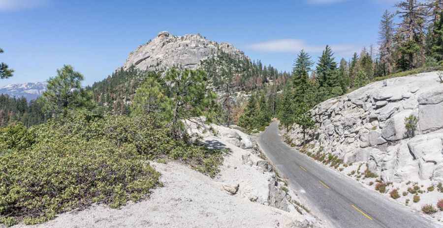
Set high on the western slope of the central Sierra Nevada, the road is 133km (83 miles) long. It has paved and unpaved (slow and bumpy but still manageable in a passenger car) parts. The drive will take you from rolling foothills to alpine forests.
Is the Sierra Vista Byway open?
The road tops out by Cold Springs Summit, at 2.233m (7,326 feet) above sea level. The byway closes each year during the winter and then reopens (June through October) once maintenance crews have had a chance to remove most of the remaining snow and make it safe for tourists to travel. The seasonal road is maintained by the National Forest Service, and opens once all the snow has melted from the upper elevations and any necessary cleanup has been completed.
Is Sierra Vista Byway in California worth it?
The journey offers breathtaking panoramas and amazing vistas. Be sure to take you camera with you. It’s a scenic driving loop through the Sierra National Forest with views of the Sierra Nevada crest, unique rock formations, granite domes, mountain streams, fishing lakes and historic buildings. You will see incredible views of the Sierra Crest. It is an excellent way to see the Sierra backcountry all from the comfort of your car.
How long does it take to drive the Sierra Vista Byway?
To drive the road without stopping will take most people between 4 and 5 hours. Gas up before you start. There’s only one place to get gas along the route (Wagner’s Store at Mammoth Pool) and the prices reflect this.
Pic: https://www.sierravistascenicbyway.com/gallery/
Map: https://www.fs.usda.gov/detailfull/sierra/maps-pubs/?cid=stelprdb5245567&width=full